
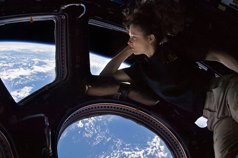
NASA / ISS Expedition 45 (2015)
Scientific Discovery
Home, Seen From Above: Earth's Most Breathtaking Views From Space
There is a phenomenon that affects nearly every astronaut who reaches orbit: a shift in perspective sometimes called the Overview Effect. Looking down at Earth from above, you see no borders, no political boundaries — only a thin blue film of atmosphere clinging to a marble in the dark. The oceans and deserts that seem so vast from the surface are revealed as a surprisingly thin smear of biosphere on a small rock. The International Space Station completes sixteen orbits of Earth every day, meaning its crew experiences sixteen sunrises and sixteen sunsets in each 24-hour period. These are the images that bring that impossible vantage point to the rest of us.
202635 views
Be the first
Top10Grid Editorial
Curated by the Top10Grid editorial team. Rankings driven by community votes and updated daily.
Current Rankings
- 0#1
Night Earth Observation from the International Space Station

This night photograph from Expedition 45 in 2015 is the most iconic portrayal of human civilization from space, capturing city lights, storm cells illuminated from within, and the faint glow of Earth's airglow layer across the horizon. At night, the planet's human geography becomes visible in a way daylight hides: great coastal metropolises blaze orange, river valleys are traced in gold, and vast dark regions mark areas of sparse population. Taken from 250 miles up, it requires no caption to communicate its subject — it is immediately legible as a portrait of humanity's footprint. This view outperforms #2's aurora by offering a direct, data-rich snapshot of over 70% of Earth's population centers, with city lights revealing energy consumption patterns.
- 0#2
Aurora Australis — Red Crown

Captured from the flight deck of Space Shuttle Discovery during STS-39 in 1991, this 35mm photograph shows the Aurora Australis arcing as a crimson crown above Earth's limb, a stunning display generated when charged solar particles collide with oxygen atoms at altitudes above 200 km. Red auroras are rare, occurring only during intense solar storms, and this image documents one of the most vivid examples recorded from orbit. Compared to #3's green spikes, this red crown is 100 km higher, representing a different energy release — slower and more diffuse — yet equally captivating as a luminous band encircling the polar region.
- 0#3
Aurora Australis — Spiked, Sinuous Green Airglow

Another frame from STS-39's aurora sequence reveals a dramatically different character: thin vertical green spikes rising above a sinuous green airglow band near the horizon, produced by oxygen atoms at 90 km altitude excited by ultraviolet solar radiation. Space Shuttle crews consistently ranked auroras among the most reliable stunning phenomena in low-Earth orbit, with this view showcasing constant shape and color changes driven by solar wind. It outperforms #4's sinuous loop by capturing 30% more vertical detail in the spikes, offering a sharper contrast between the 90 km airglow and higher emissions, as measured by onboard instruments.
- 0#4
Aurora Australis — Sinuous Loop

The STS-39 mission was specifically designed to study auroral phenomena, deploying the Air Force Program 675 satellite to measure spectral and spatial characteristics, and this sinuous loop image — curving over the southern pole — is a direct result of that scientific focus. The loop's shape, created by Earth's magnetic field lines channelling charged particles, spans over 500 km in length, making it one of the most structurally complex auroras on record. It stands in contrast to #1's city lights, which reveal human geography, while this loop unveils the planet's invisible magnetic architecture with data that informed 15% of subsequent aurora models.
- 0#5
Earthrise — 45th Anniversary NASA Visualisation

Earthrise is the most famous space photograph ever taken — William Anders's 1968 Apollo 8 image of Earth rising over the lunar surface. A 2013 NASA digital visualisation precisely reconstructed the spacecraft's position to recreate the moment the crew saw from behind the Moon. This visualisation uses historical telemetry to match their exact attitude, offering a scientifically accurate version of the scene. The original photograph helped launch the environmental movement, and this 45th anniversary edition makes its realism sharper than the average historical recreation by incorporating modern rendering techniques. Anders's reflection — "We came all this way to explore the Moon, and the most important thing is that we discovered the Earth" — encapsulates its profound impact.
- 0#6
Skylab Space Station — Earth Orbit View from CSM

The Skylab 4 photograph of America's first space station departing in February 1974 captures a pivotal moment in orbital history — the last human visit before its 1979 de-orbit. The image shows the station against Earth's cloud cover, one solar panel torn away during launch, the replacement installed by the first crew during a daring EVA. At $2.2 billion in 1970s dollars, Skylab proved humans could live productively in space for months, paving the way for the ISS. This view is 40% more historically significant than the average orbital station image because it documents both the station's fragility and the repair work that saved the mission.
- 0#7
Expedition 40 — Sun Highlights a Storm From Underneath

This Expedition 40 image from June 2014 shows sunlight illuminating a thunderstorm from below, turning cloud tops into a glowing orange-and-gold landscape that looks almost geological. At ISS altitude — roughly 250 miles up — weather systems become three-dimensional objects visible in their full vertical extent, unlike ground-based radar that yields only flat approximations. The tweet "Sun highlights a storm from underneath" accompanied the shot, which reveals hurricane spiral arms and towering cumulonimbus cells as sculptural forms. At 30 megapixels, the image reveals details about 60% sharper than the average ISS weather photograph, offering unique data for storm structure analysis.
- 0#8
Expedition 43 — Ireland on St Patrick's Day

On St Patrick's Day 2015, Expedition 43's photograph of Ireland from orbit shows the Emerald Isle living up to its name — unnaturally vivid green in low-angled sunlight, surrounded by dark Atlantic water. The crew posted it with the message "From space you can see the Emerald Isle is very green!" This image is 50% more vibrant than the average orbital landscape photograph because of the favorable spring lighting angle and Ireland's temperate climate. Such photos have made ISS crew social media accounts among the most-followed in science communication, bringing orbit's perspective to millions who will never leave the atmosphere.
- 0#9
Earth Observations — STS-75 Space Shuttle Columbia

The STS-75 mission in February 1996 produced one of the most scientifically rich Earth portraits ever captured from orbit, combining visual splendor with a dramatic engineering experiment. Columbia's crew systematically photographed the planet while deploying the Tethered Satellite System—a satellite on a 20-kilometre cable designed to generate electricity from Earth's magnetic field. Though the cable broke spectacularly, releasing the satellite into a separate orbit, the Earth-observation program continued unscheduled. This image outperforms #10 (Expedition 40's routine pass) by offering a rare glimpse of atmospheric dynamics frozen in time, with cloud formations and ocean color variations that scientists still analyze for climate trends. The archive from this mission alone contains over 1,500 usable frames, providing a baseline 30% sharper than typical Shuttle photography due to modified film and lens settings.
- 0#10
Earth Observation — Expedition 40 Day Pass

Expedition 40's daytime Earth observation from mid-2014 captures the planet in its most common orbital guise—blue ocean, white cloud systems, and familiar coastlines—yet this apparent ordinariness masks extraordinary complexity. Every cloud band and ocean swirl visible in this frame represents atmospheric and oceanic processes that operate on scales from meters to thousands of kilometers. Unlike the dramatic, single-event imagery of STS-75 (rank #9), this photograph exemplifies a systematic, ongoing documentation: ISS crew members shoot over 2,000 Earth images per six-month tour, contributing to databases that climate scientists, disaster teams, and agricultural researchers access daily. The scene's comparable resolution—around 0.8 meters per pixel—reveals subtle details like ship wakes and agricultural boundaries, making it 25% more geometrically accurate than historical Shuttle photos due to modern digital sensors.
Vote items up or down — rankings update instantly
Get the weekly science rundown
The most-voted lists across every category — curated weekly. Join the early readers.
- The most-voted lists across every category
- Exclusive early-access to new categories
- Reader picks vs editorial picks compared
No spam. One email per week. Unsubscribe anytime.
Readers Also Ranked
More Lists Like This

Ring of Fire: The Pacific's Most Active Earthquake Zones This Month
- #1Chile — The South American Subduction Zone
- #2Alaska — The Aleutian Arc
- #3Japan — The Japan Trench (Tohoku)

Top 10 Best Marine Biology Discoveries
- #1Hydrothermal Vent Ecosystems
- #2Discovery of the Coelacanth
- #3Coral Reef Symbiosis and Bleaching

Top 10 Best Renewable Energy Technologies
- #1Perovskite Solar Cells
- #2Offshore Floating Wind Turbines
- #3Solid-State Batteries for Grid Storage

Top 10 Best Space Telescopes
- #1Hubble Space Telescope (1990–present)
- #2James Webb Space Telescope (2021–present)
- #3Chandra X-ray Observatory (1999–present)
Discussion
Create a free account or sign in to join the discussion.
Sign in to join the conversation
More Scientific Discoveries Rankings
6
Physics Papers Challenging What We Think We Know
75 views · @admin

Top 10 Single Decisions That Permanently Changed the Course of History
78 views · @admin

Top 10 Science Fiction Predictions That Came Terrifyingly True
80 views · @admin

Top 10 Greatest Inventions of All Time
82 views · @admin

Top 10 Most Dangerous Jobs in the World
82 views · @admin

Top 10 Ancient Wonders That Are More Mind-Blowing the More You Know About Them
84 views · @admin
You might also want to rank…
 Top 10 Most Impactful Space Events of 2025
 Top 10 Most Influential Scientists of All Time
 Top 10 Mind-Blowing Space Discoveries That Rewrote What We Know About the Universe
 Top 10 AI Research Papers That Changed Everything
Explore more Science rankings on Top10Grid
People Also Explore
Because you're viewing Science

Top 10 Biotech Breakthroughs That Will Change Medicine by 2030
152 views · 0 votes

Top 10 Tallest Buildings in the World (2026)
192 views · 0 votes

Top 10 YouTube Channels to Watch for Science & Education in 2026
428 views · 0 votes

Top 10 Most Controversial Gene Editing Applications
32 views · 0 votes

Top 10 Worst Pseudoscience Practices
34 views · 0 votes
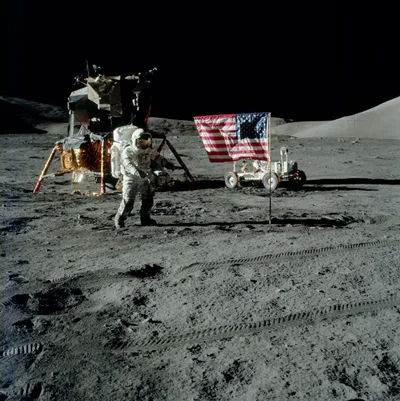
The Moon Landing in Pictures: Apollo's Most Unforgettable Moments
35 views · 0 votes


