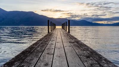
Michal Klajban / Wikimedia Commons (CC BY-SA 4.0)
Top 10 Lakes of Indonesia 2026
Ten of Indonesia's most striking lakes, from a supervolcano caldera in Sumatra to three colour-changing crater lakes on Flores, with size and access facts.
Top10Grid lets the community re-rank anything — this order is our editors' pick for now; use the buttons below to vote it up or down.

Current Rankings
- –
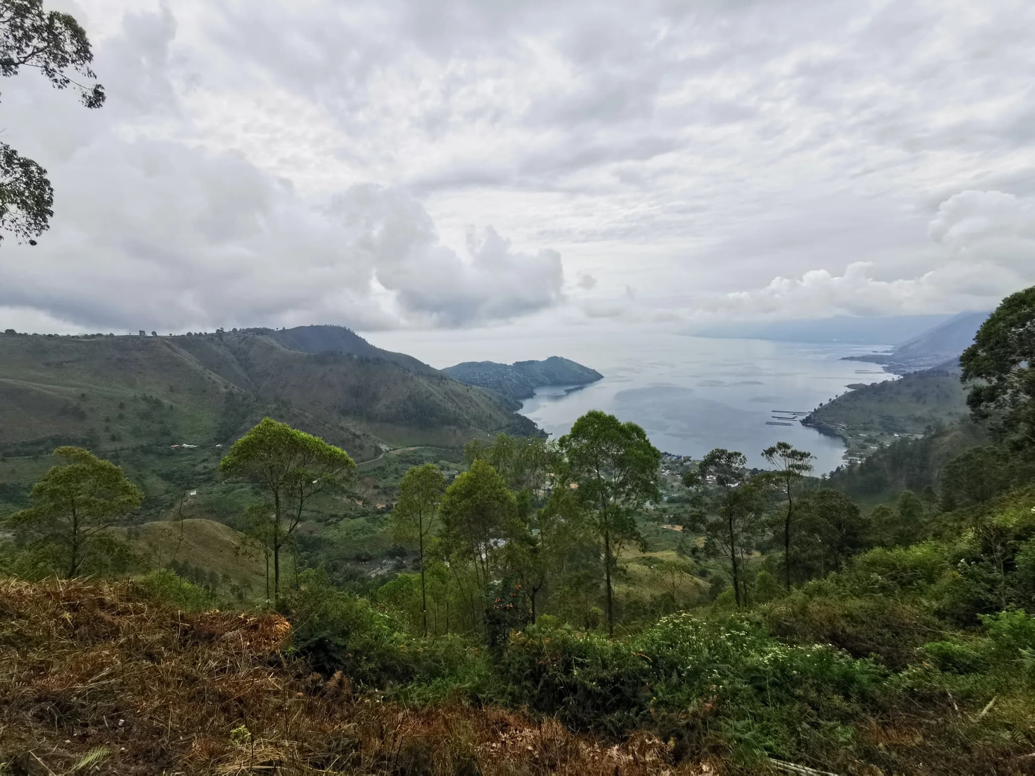
Lake Toba is the largest volcanic lake in the world and the centrepiece of Indonesia's lake country. It fills the caldera left by the eruption of the Toba supervolcano roughly 73,700 years ago, an event measured at magnitude 8 on the Volcanic Explosivity Index and considered the largest explosive eruption anywhere on Earth in the past 25 million years. The blast is estimated to have ejected around 2,800 cubic kilometres of pyroclastic material, and the resulting collapse created a basin 100 kilometres long and 30 kilometres wide. At the centre of the lake sits Samosir Island, itself a product of the same volcanic system: magma refilling the emptied chamber beneath the caldera has pushed the island's resurgent dome up by at least 450 metres since the eruption. Samosir is where most visitors base themselves, and it is also the historic heartland of the Batak people, whose traditional houses are immediately recognisable by roofs that curve upward at each end like the hull of a boat, decorated with carved and painted panels. Villages such as Tomok and Ambarita preserve traditional Batak architecture and stone seats once used for community councils. The lake's water sits at 905 metres above sea level and reaches a maximum depth of 505 metres, giving it an enormous volume that moderates the surrounding climate into something cooler and drier than the tropical lowlands nearby. Parapat, on the mainland shore, is the main gateway: a passenger ferry runs from its harbour across to Tuk Tuk on Samosir in under an hour, and the town connects onward to Medan by the Trans-Sumatran Highway, a drive of a little over three hours, or a shorter hop from the regional Silangit airport near Balige. Around the shoreline, hot springs, waterfalls and hillside viewpoints such as Tele give a sense of just how large the caldera really is, something that is difficult to grasp fully except from the air or from Samosir's own high ground.
- –#2
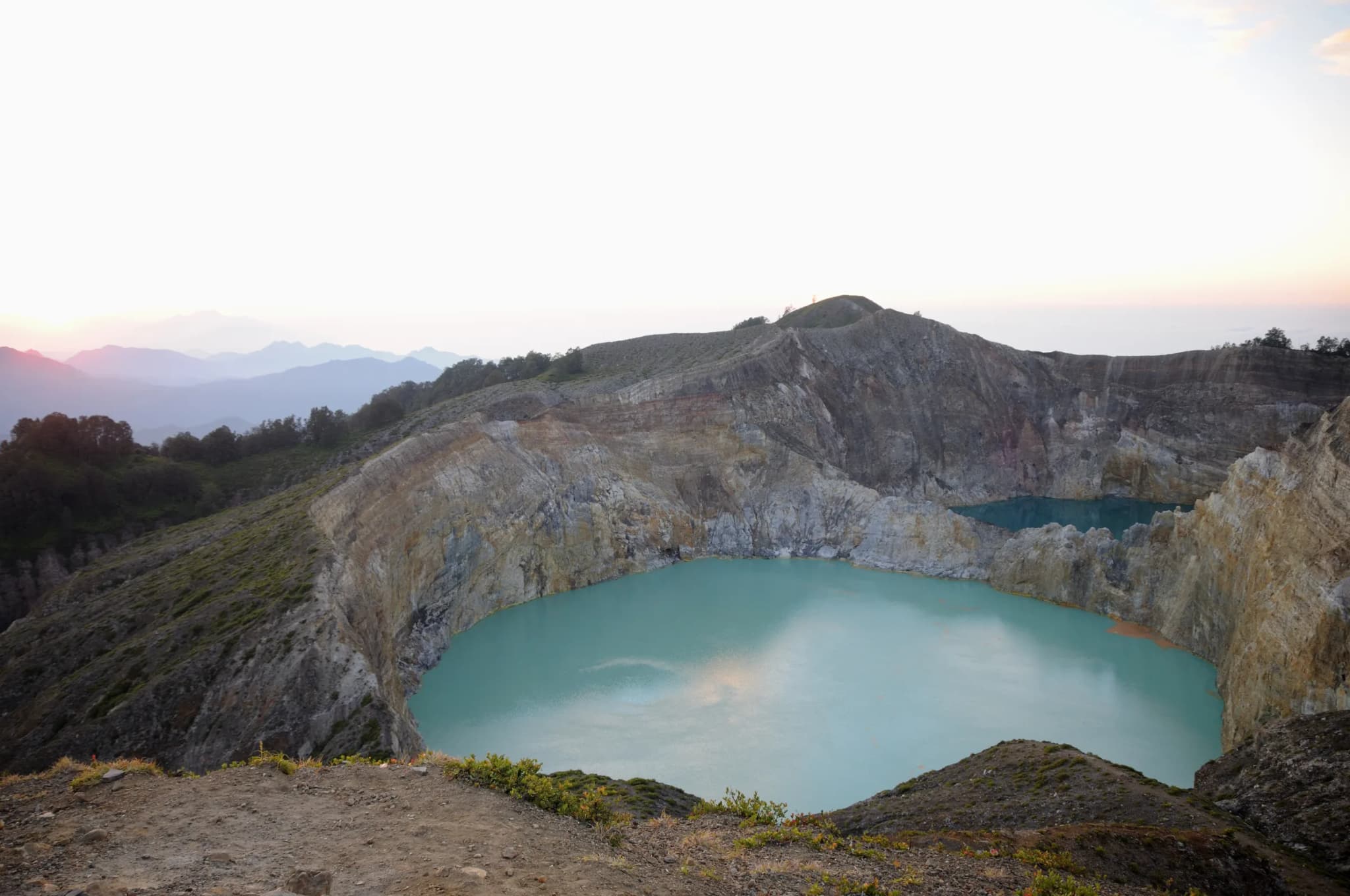
On the eastern end of Flores island, three crater lakes sit almost side by side at the 1,639-metre summit of Kelimutu volcano, and each one keeps a different colour from its neighbours. Local Lio tradition names them Tiwu Ata Bupu, the Lake of Old People, usually blue; Tiwu Nuwa Muri Koo Fai, the Lake of Young Men and Maidens, typically green; and Tiwu Ata Polo, the Bewitched or Enchanted Lake, usually red. The colours are not fixed: over the decades since they were first recorded, each lake has cycled through shades of turquoise, brown, black and white, sometimes changing within the same year. The mechanism is chemical rather than decorative. Subaqueous fumaroles beneath each lake release volcanic gases, chiefly sulfur dioxide and hydrogen sulfide, and the resulting oxidation-reduction reactions shift dissolved minerals between different coloured states. Acidity varies enormously between the three lakes and over time, with recorded pH levels as low as 0.5 in the most acidic. Because each lake sits in its own separate crater with its own plumbing, they change independently of one another rather than in sync, which is part of why the site draws repeat visitors and long-term researchers alike, including monitoring linked to the Smithsonian Institution's Global Volcanism Program. Kelimutu sits inside Kelimutu National Park in Ende Regency, East Nusa Tenggara province, about 50 kilometres east of the regional city of Ende. Most visitors fly into Ende or the larger airport at Maumere, then drive roughly three hours to the small hillside town of Moni, the usual overnight base. From Moni it is about 45 minutes further by road to the park's vehicle park, followed by a short, well-maintained walk to the viewpoint overlooking all three lakes. Sunrise is the customary time to go: cloud tends to build over the crater rim as the morning goes on, and the low light is when the colours read most clearly against the pale volcanic rock.
- –
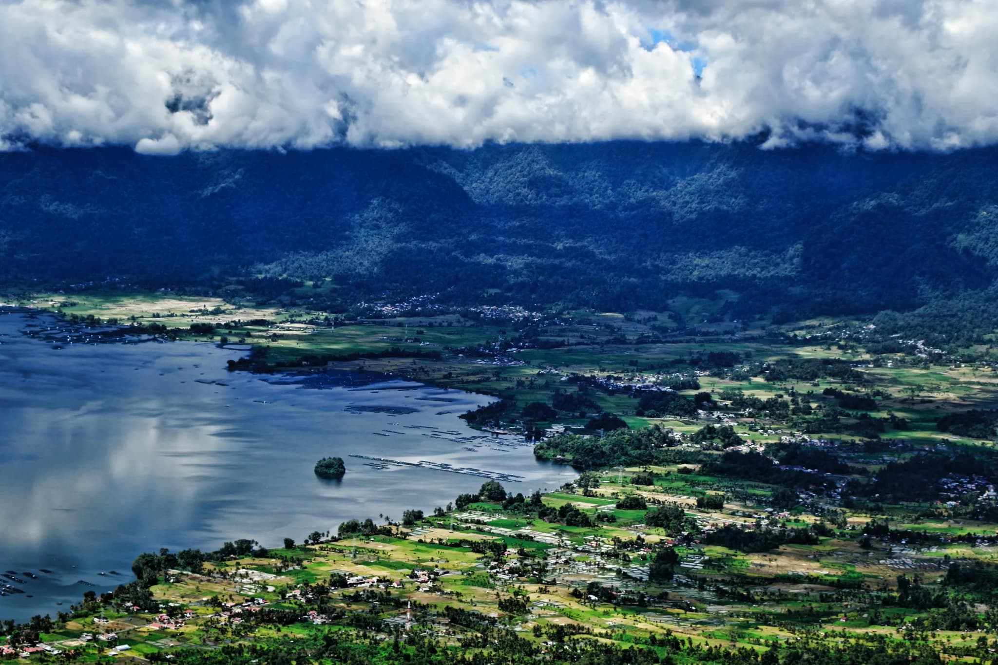
Lake Maninjau fills a caldera in the hills above the West Sumatran coast, formed by a volcanic eruption around 52,000 years ago that is estimated to have deposited between 220 and 250 cubic kilometres of material across roughly 8,500 square kilometres. What remains today is a lake 16 kilometres long and 7 kilometres wide, sitting at 459 metres above sea level, with an average depth of 105 metres and a recorded maximum of 165 metres. The lake takes its name from the Minangkabau word for overlook or observation, and the Minangkabau people who farm its shores and terraced rice slopes make up the great majority of the surrounding population. The connection between the lake and Minangkabau identity runs deep enough that Indonesia's first president, Sukarno, wrote a pantun, a traditional rhymed verse form, praising the lake after visiting in June 1948, a poem still quoted locally as a mark of the lake's standing in national memory. Since 1983, Lake Maninjau has done double duty as a source of electricity: water is diverted out through the Antokan River to a hydroelectric station that generates around 68 megawatts for the West Sumatra grid, one of a handful of Indonesian lakes put to this kind of infrastructural use. The descent to the lakeshore from the regional hub of Bukittinggi is itself a minor attraction, a switchback mountain road known locally as Kelok 44 that drops through more than forty numbered bends before levelling out at the water's edge. Around the lake, small towns such as Maninjau and Bayua provide the main guesthouses and jumping-off points, and Lawang, above the caldera rim, is the classic viewpoint for photographing the full width of the lake with its ring of green hills. The calm, warm water and gentle climate at 459 metres make it a popular weekend escape from the heat of the Sumatran lowlands.
- –
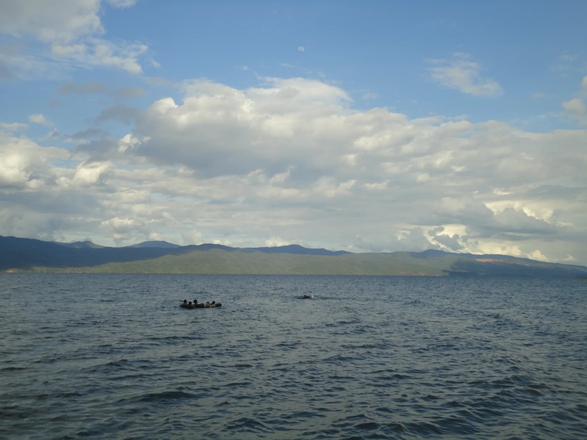
Lake Matano is the deepest lake in Indonesia and the eleventh deepest in the world, reaching 590 metres at its lowest point, a depth so extreme that the bottom of the lake actually sits below sea level, a rare condition known as a cryptodepression. The lake formed in a tectonic graben, a section of crust that dropped between parallel faults, somewhere between one and two million years ago, making it one of the oldest lakes in Southeast Asia. It stretches 28 kilometres long and 8 kilometres wide across a surface area of 164.1 square kilometres, ringed by the forested hills of East Luwu Regency in South Sulawesi. Age and isolation have made Matano a byword among freshwater biologists for endemic life. Roughly a fifth of the lake's diatom species exist nowhere else, and its animal life follows the same pattern: several endemic fish species, freshwater shrimp of the genus Caridina, crabs from the Parathelphusid family and snails of the genus Tylomelania have all evolved in place, in a burst of local diversification researchers have compared to the species swarms of Africa's Rift Valley lakes. The physics of the lake are just as unusual as its biology. Because the surrounding climate stays warm and stable year-round, the water column never fully mixes the way temperate lakes do each winter, leaving a stagnant deep layer that scientists studying early Earth chemistry treat as a working analogue for the anoxic, low-oxygen oceans of the Archean Eon, more than 2.5 billion years ago. Sorowako, on the lake's eastern shore, is the main access point and home to one of Indonesia's largest nickel-processing operations; a passenger ferry crosses between it and the settlement of Nuha. Most visitors combine Matano with a look at neighbouring Lake Towuti, connected by the short Larona River, from hillside viewpoints that take in both lakes at once.
- –
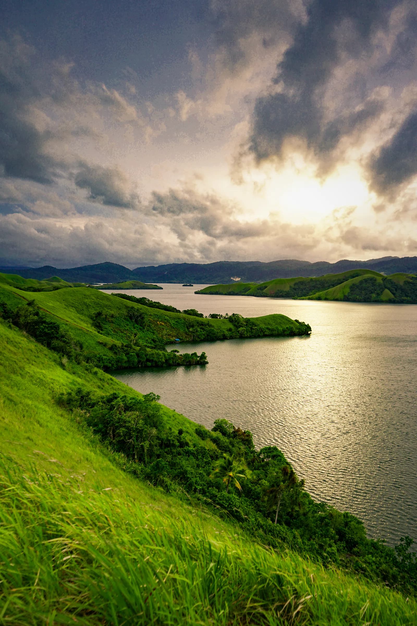
Lake Sentani is Papua's best-known lake, spreading 28 kilometres from east to west and 19 kilometres north to south across the lowlands about 20 kilometres from the provincial capital, Jayapura. Around a hundred square kilometres of water sits ringed by the Cyclops Mountains, and dozens of small islands and inlets break up what would otherwise be a single open sheet of water. The lake's most distinctive human feature is architectural: many Sentani families still live in houses built on posts directly over the water, a tradition documented in the region for well over a century and visible today in villages scattered along the shoreline. Photographs and museum collections from the early twentieth century, including material held by the Netherlands' National Museum of World Cultures, show these pile-dwelling villages and the dugout canoes, or proas, that connect them, alongside men's ceremonial houses raised on the same style of stilts. Isolation has produced its own wildlife here too. The lake is home to fish found nowhere else on Earth, among them the Sentani rainbowfish and red rainbowfish, plus a distinct goby and gudgeon species unique to these waters. Less fortunate is the Sentani sawfish: freshwater sawfish up to three metres long were a well-documented feature of the lake as recently as the 1970s, but they have since disappeared entirely. At the lake's northwest end, the archaeological site of Doyo Lama holds megalithic stones carved with petroglyphs, which some researchers connect to prehistoric contact with Micronesia rather than mainland New Guinea traditions. Growing settlement around the shoreline has also brought a modern problem: untreated household waste draining into the lake has raised coliform bacteria levels in parts of the water. Sentani town, a short drive from Jayapura's airport, remains the easiest base for visiting the lake and its stilt villages by chartered boat.
- –
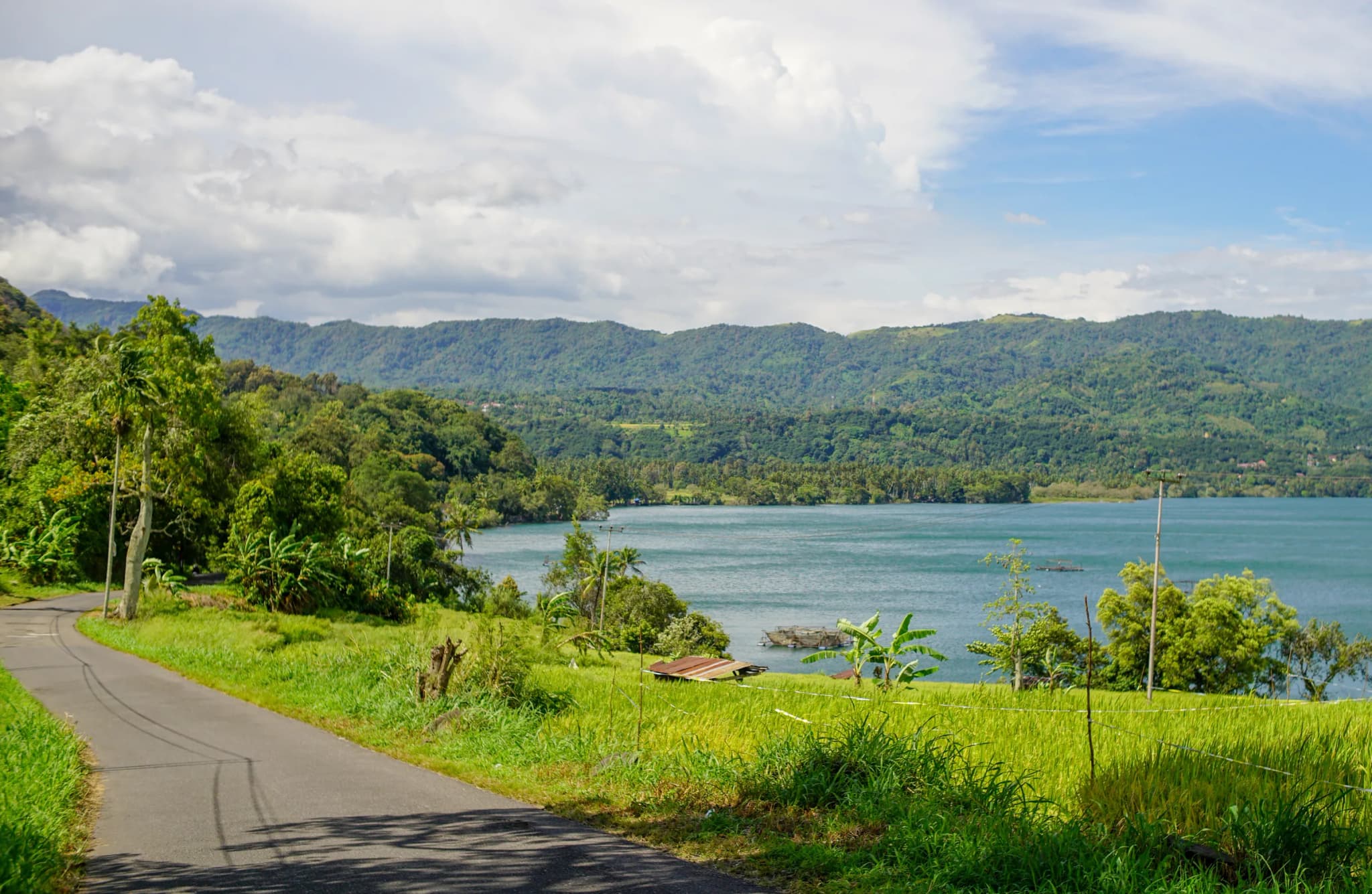
Lake Singkarak is West Sumatra's second-largest lake after Maninjau, a tectonic basin stretching almost 21 kilometres between the regencies of Tanah Datar and Solok. It sits at 362 metres above sea level, covers 107.8 square kilometres, and reaches a maximum depth of 268 metres, with an average closer to 149 metres, figures that place it among the deeper lakes on this list even though it rarely gets the same attention as its more famous neighbour. The lake's defining creature is ikan bilih (Mystacoleucus padangensis), a small silvery fish found naturally only in Singkarak's waters and long harvested by local fishing communities as both food and income. Ikan bilih has since been introduced to a handful of other Indonesian lakes as a food fish, but Singkarak remains its original home, and dried or fried bilih is sold throughout the surrounding Minangkabau towns as a regional speciality. Much of the lake's natural outflow has been diverted through a tunnel to the Anai River, which runs west to the Indian Ocean near Padang rather than following its old drainage path. The diverted water now powers the Singkarak hydroelectric station, which supplies electricity to both West Sumatra and neighbouring Riau province, making the lake one of Sumatra's working pieces of energy infrastructure as well as a scenic destination. Villages along the eastern and western shores, reachable from Padang by a drive of roughly two hours or from Bukittinggi via the Anai Valley road, offer simple lakeside restaurants that serve bilih fresh from the water, along with grilled fish and rice, making a lap of the shoreline one of the more relaxed half-day trips out of either city.
- –
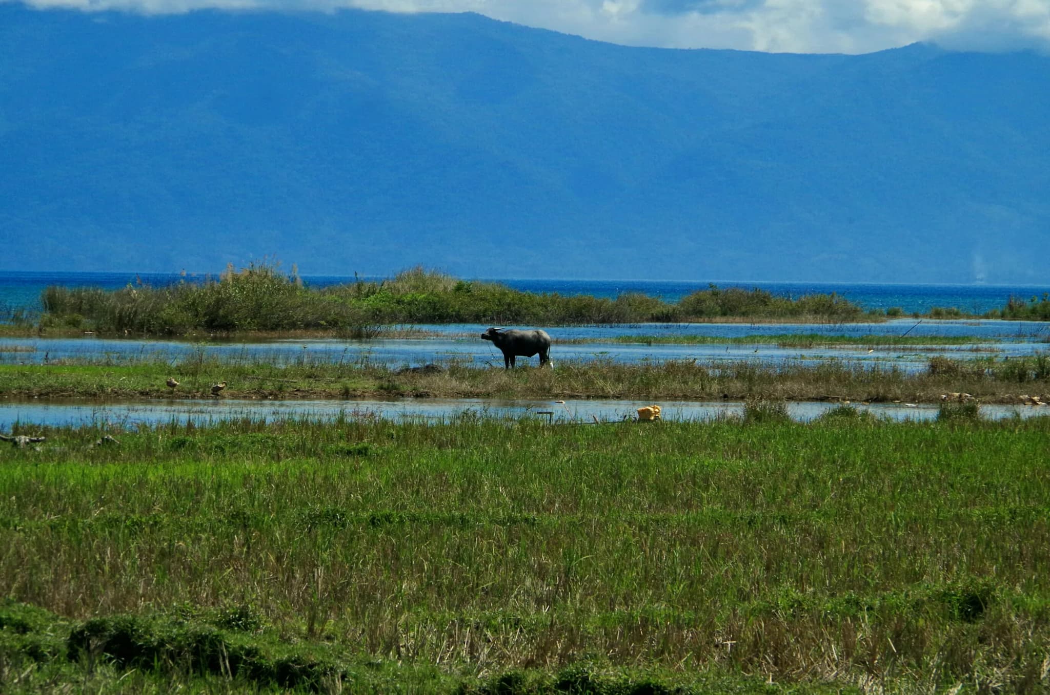
Lake Poso is Central Sulawesi's largest lake and, at a maximum depth of 450 metres, the third-deepest in Indonesia. It covers 323.2 square kilometres, holds an estimated 21.6 cubic kilometres of water, and sits at 485 metres above sea level inside a tectonic basin shaped by the same fault systems that run through much of central Sulawesi. Like Matano and Towuti to the south, Poso is an ancient lake with a correspondingly rich list of species found only here: eleven endemic fish, including several ricefish, gobies and halfbeaks; eleven endemic species of Caridina shrimp; freshwater snails of the genus Tylomelania; and crabs from three different Parathelphusid genera. That richness is now under serious pressure. Researchers studying the lake describe its endemic species as highly threatened, with some populations possibly already extinct, largely because introduced fish, Mozambique tilapia and common carp among them, have outcompeted and preyed on native species since being introduced for aquaculture. The lake's Indigenous population, the Pamona people, have fished and farmed its shores for generations, and Poso remains central to Pamona cultural identity in Central Sulawesi. Tentena, at the lake's northern tip, is the main gateway town, with guesthouses and one of the region's best-known church buildings overlooking the water; Pendolo anchors the southern shore, and the small village of Bancea, partway along the eastern side, is known locally for an orchid park showcasing wild species collected from the surrounding forest. Reaching Lake Poso typically means flying into Palu, the provincial capital, and driving several hours south to Tentena, or approaching from the south toward Poso town and the Trans-Sulawesi highway network. The lake's clear water has also drawn a small dive and snorkel following, though facilities remain modest compared with Indonesia's more developed lake destinations.
- –
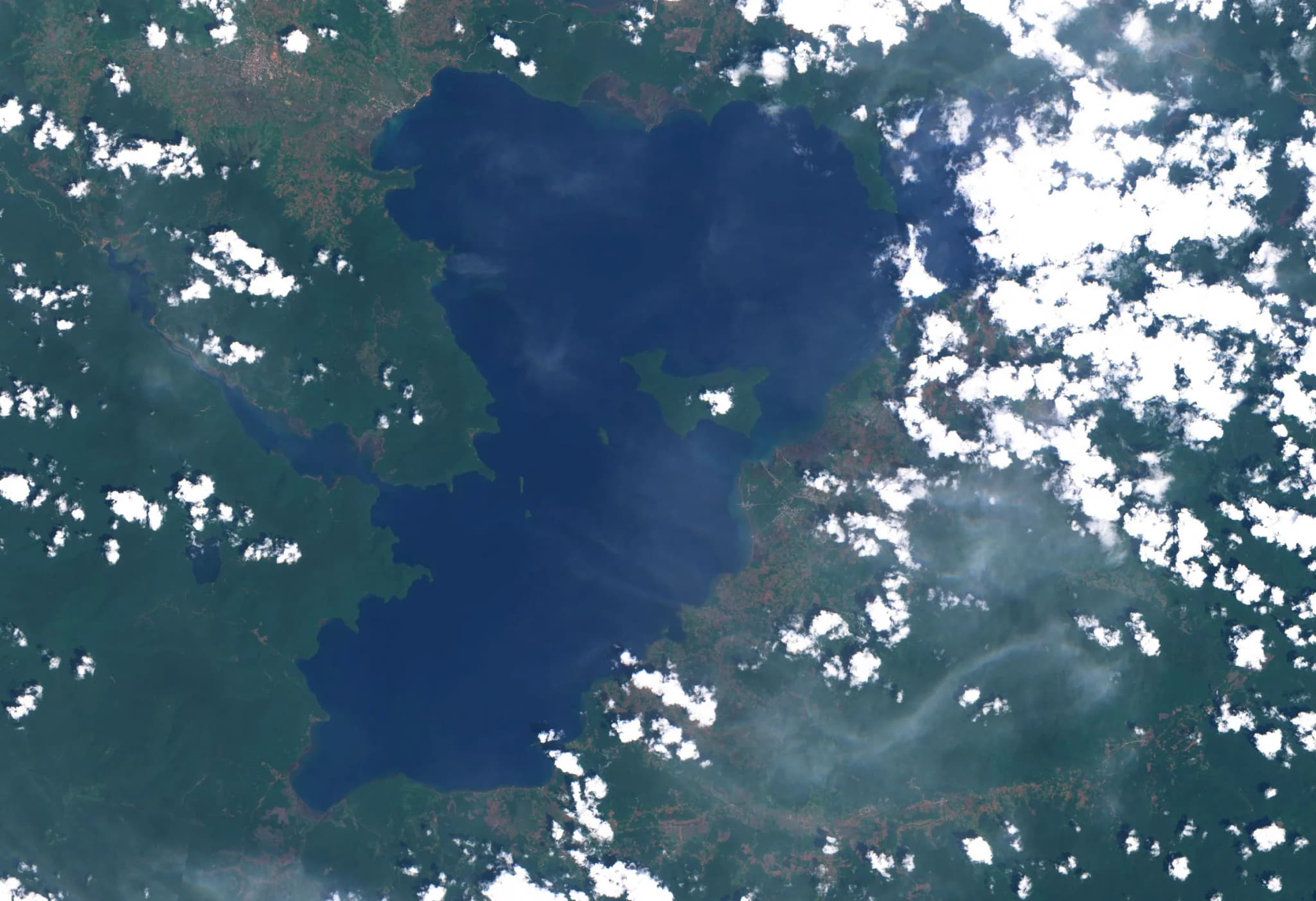
Lake Towuti is the largest lake on the island of Sulawesi by surface area, spreading across 561.1 square kilometres of a tectonic basin in East Luwu Regency, South Sulawesi. It sits at 293 metres above sea level, with an average depth of 120 metres and a maximum of 203 metres, and it holds an estimated 67.33 cubic kilometres of water, smaller by depth than its neighbour Matano, to which it is connected by the short Larona River, but larger in surface area than any other lake in the province. Towuti belongs to the same ancient Malili lake system as Matano and shares its reputation for unusual, highly localised wildlife. Telmatherinid sailfin silversides, small and often brightly finned fish, have diversified here into several forms found nowhere else, alongside endemic gobies and halfbeaks. The lake's most scientifically distinctive resident may be Caridina spongicola, a freshwater shrimp that lives exclusively on freshwater sponges in the lake, one of only two commensal freshwater shrimp species known anywhere in the world. Endemic Tylomelania snails and Parathelphusid crabs round out a food web that has evolved in relative isolation for hundreds of thousands of years. The lake's shoreline is dominated by the mining town of Sorowako, which sits on the strip of land separating Towuti from Lake Matano and serves as the practical base for visiting either lake. From viewpoints in the hills above Sorowako, both lakes are visible at once, laid out in the forested basin like two halves of a single landscape. Because Towuti and Matano sit in a remote part of interior South Sulawesi, most visitors reach the area by a domestic flight to a regional airstrip followed by a road transfer, and facilities remain oriented toward research and mining-industry travel rather than mass tourism, which keeps both lakes quiet even by Indonesian standards.
- –
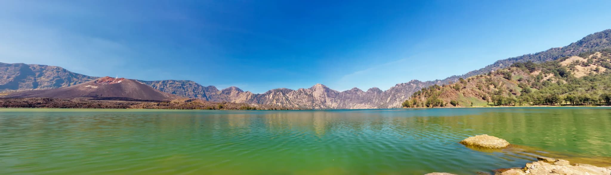
Segara Anak is the crater lake filling the caldera of Mount Rinjani on Lombok, and at 2,004 metres above sea level it is Indonesia's second-highest caldera lake sitting beside an active volcano. The caldera itself is the scar of one of the most violent eruptions in recorded history: in 1257, the volcano then known as Mount Samalas collapsed in an eruption that ejected an estimated 10 cubic miles of dense-rock-equivalent material, an event some climate researchers link to a documented period of global cooling in the centuries that followed. What remains today is a lake 7.5 by 6.0 kilometres across, covering 11.3 square kilometres and reaching 230 metres at its deepest point. Its name, Segara Anak, means child of the sea in reference to the water's deep blue, ocean-like colour, an image well known enough in Indonesia that the lake appears on the 10,000-rupiah banknote. At the lake's eastern edge, the young volcanic cone of Gunung Barujari rises to 2,376 metres, an active vent that gives the lake its distinctive crescent shape by crowding against one side of the caldera. Because magma still sits close beneath the caldera floor, the lake runs warm for its altitude: recorded temperatures of 20 to 22 degrees Celsius are some five to seven degrees higher than would be expected at 2,000 metres, warm enough for swimming despite the surrounding cold mountain air. The lake was originally fishless, but a stocking programme begun in 1985 introduced tilapia and carp, which bred rapidly and turned Segara Anak into a working fishery as well as a trekking destination; anglers and campers now share its shores with hikers. Reaching the lake requires a multi-day trek within Gunung Rinjani National Park, most commonly via the Sembalun or Senaru trailheads, with an overnight camp on the crater rim before the steep descent to the water, a serious undertaking reserved for prepared, guided hikers rather than a casual day trip.
- –#10
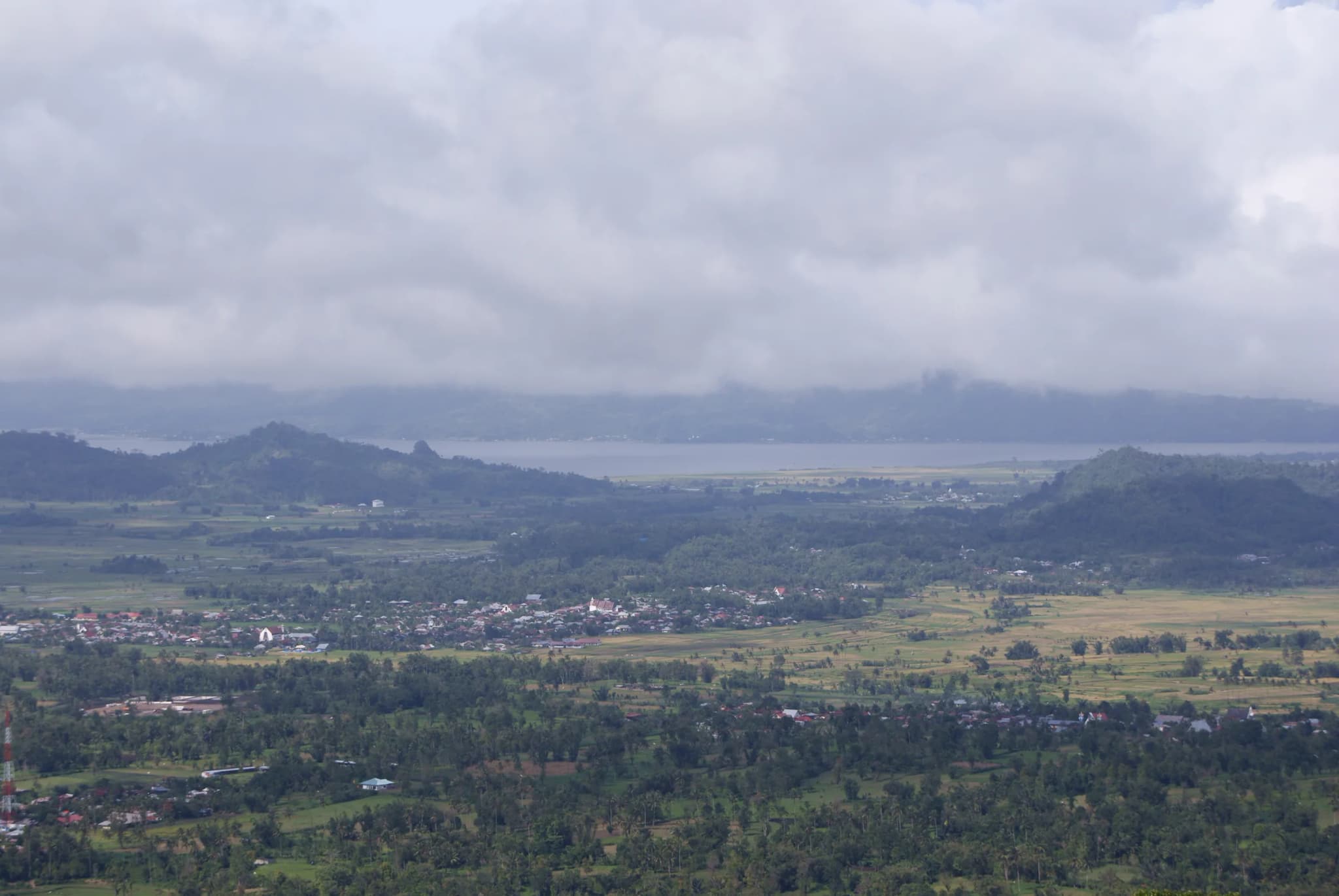
Lake Tondano is the largest lake in North Sulawesi, sitting at 600 metres above sea level in the highlands about 36 kilometres south of the provincial capital, Manado. It has long served the Minahasa people as both a food source and a transport route, and the lakeside town of Tondano, capital of Minahasa Regency, has grown up around its northern shore. The lake is home to two species found nowhere else: Tondanichthys kottelati, a small halfbeak fish, and Phyllodiaptomus sulawesensis, a species of calanoid copepod first described from Tondano's waters. Both are recorded in the FishBase reference database devoted to global fish biodiversity, which treats Tondano as a distinct evolutionary pocket much like Poso, Matano and Towuti further south, even though it sits in a very different, much shallower kind of basin. That shallowness has become the lake's defining modern problem. Measurements cited in a 2010 Jakarta Post report on the lake's condition found average depth had fallen to around 12 metres, down from roughly 40 metres recorded in 1934, a decline discussed locally in connection with sediment washing in from the surrounding slopes and pressure from fish-cage farming in the shallows. Local and national authorities have since discussed dredging and catchment programmes to slow the trend, a subject that comes up regularly in regional tourism-forum discussions about the lake's future. For now, Tondano remains a working lake rather than a purely scenic one: fish cages dot large sections of the water, and the shoreline road connecting Tondano town to the Bukit Kasih volcanic park nearby gives sweeping views down over the basin. Manado's Sam Ratulangi International Airport puts the lake within an easy day trip of the coast, making it one of the more accessible entries on this list even as its long-term health remains an open question.
| Item | Location | Formation | Surface area | Getting there | Maximum depth | Surface elevation |
|---|---|---|---|---|---|---|
| #1Lake Toba | Samosir Island area, North Sumatra | Caldera of the Toba supervolcano eruption, roughly 73,700 years ago (VEI 8) | 1,130 km² | Fly to Silangit or Kualanamu (Medan) airport, drive to Parapat, then take the ferry to Samosir Island | 505 m | 905 m |
| #2Kelimutu | Kelimutu National Park, Ende Regency, Flores, East Nusa Tenggara | Three separate crater lakes at the summit of Kelimutu volcano | Not published separately for the three crater lakes | Fly to Ende or Maumere, drive about 3 hours to Moni, then 45 minutes to the park entrance and a short walk to the vie… | Not published separately for the three crater lakes | 1,639 m (summit) |
| #3Lake Maninjau | Agam Regency, West Sumatra | Caldera eruption approximately 52,000 years ago | 99.5 km² | Drive from Bukittinggi via the Kelok 44 switchback road, or from Padang | 165 m | 459 m |
| #4Lake Matano | East Luwu Regency, South Sulawesi | Tectonic graben, formed 1–2 million years ago | 164.1 km² | Fly to a regional airstrip near Sorowako, then road and the Nuha–Sorowako ferry crossing | 590 m — deepest lake in Indonesia, 11th-deepest in the world | |
| #5Lake Sentani | Jayapura Regency, Papua | Lowland lake at the foot of the Cyclops Mountains | 104 km² | Fly into Jayapura's Sentani Airport, then a short drive to Sentani town and a chartered boat | ||
| #6Lake Singkarak | Between Tanah Datar and Solok Regencies, West Sumatra | Tectonic lake | 107.8 km² | About 2 hours by road from Padang, or via the Anai Valley road from Bukittinggi | 268 m | 362 m |
| #7Lake Poso | Poso Regency, Central Sulawesi | Tectonic lake | 323.2 km² | Fly to Palu, then drive several hours south to Tentena on the lake's northern shore | 450 m — third-deepest lake in Indonesia | 485 m |
| #8Lake Towuti | East Luwu Regency, South Sulawesi | Tectonic lake, part of the Malili lake system | 561.1 km² — largest lake in Sulawesi | Fly to a regional airstrip, then a road transfer to Sorowako | 203 m | 293 m |
| #9Segara Anak | Caldera of Mount Rinjani, Lombok | Caldera of Mount Samalas, formed by the 1257 eruption | 11.3 km² | Multi-day trek within Gunung Rinjani National Park via the Sembalun or Senaru trailhead | 230 m | 2,004 m |
| #10Lake Tondano | Minahasa Regency, North Sulawesi | Not specified in cited sources | About 45 minutes to 1 hour by road from Manado's Sam Ratulangi Airport | About 12 m as of 2010, down from about 40 m in 1934 | 600 m |
Image credits
- Lake Toba: Photo by Herman Kurniawan, CC BY-SA 4.0, via Wikimedia Commons
- Kelimutu: Photo by Josep M. Gracia, CC BY-SA 4.0, via Wikimedia Commons
- Lake Maninjau: CC0 (public domain), via Wikimedia Commons
- Lake Matano: Photo by Reswaaaa, CC BY-SA 4.0, via Wikimedia Commons
- Lake Sentani: Photo by Bunayadarunawa, CC BY-SA 4.0, via Wikimedia Commons
- Lake Singkarak: Photo by Zakiyyan, CC BY-SA 4.0, via Wikimedia Commons
- Lake Poso: Photo by Rainer Jehl, CC BY-SA 4.0, via Wikimedia Commons
- Lake Towuti: European Space Agency, CC BY-SA 3.0 IGO, via Wikimedia Commons
- Segara Anak: Photo by Edwind CK, CC BY-SA 4.0, via Wikimedia Commons
- Lake Tondano: Photo by Sakurai Midori, CC BY 2.5, via Wikimedia Commons
Rank it your way
Remix this list into your own ranking, or head to the play hub for every game mode and community breakdown — blind mode, challenges, tier lists, and more.
You Might Also Like
Top 10 Tulip & Flower Experiences in the Netherlands 2026
Top 10 Tulip & Flower Experiences in the Netherlands 2026
Top 10 Mountain Hikes in Taiwan in 2026
Top 10 Mountain Hikes in Taiwan in 2026

Top 10 Best Diving Ecosystems
Top 10 Best Diving Ecosystems

Top 10 Worst Air Quality Cities
#1 Lahore, Pakistan · #2 Delhi, India · #3 Dhaka, Bangladesh

Top 10 Indonesian Wildlife Encounters in 2026
#1 Komodo Dragons · #2 Sumatran Orangutans · #3 Bornean Orangutans

Top 10 Indonesian National Parks in 2026
#1 Komodo National Park · #2 Gunung Leuser National Park · #3 Tanjung Puting National Park