Verified MethodologyDestination Quality 45% · Access & Transit 30% · Seasonal Value 25%
Mount Aragats vs. Mount Kaputjugh? Top 10 Highest Mountain Peaks in Armenia (2026)
The Republic of Armenia occupies an intensely folded and volcanic sector of the South Caucasus, situated entirely within the Armenian Highlands between the Black Sea and Caspian basins. With an average countrywide elevation exceeding 1800…
Read more
meters, over 90 percent of the nation lies above 1000 meters elevation, sculpted by massive Neogene-Quaternary volcanic massifs, fault-block cordilleras, and alpine plateaus. The nation's highest elevations span 3 principal geological provinces: the colossal 4-peaked stratovolcano of Mount Aragats in western Armenia, the active tectonic spine of the Zangezur Mountains along the southern frontier with Azerbaijan, and the volcanic highlands of the Gegham and Vardenis ranges enclosing Lake Sevan. These 10 summits exceed 3300 meters above sea level, preserving high-altitude crater tarns, glacial cirques, and alpine meadows where endangered Armenian mouflon and Caucasian leopards roam. Benchmarked strictly by official geodetic triangulation and certified vertical summit elevation, this catalog establishes the verified topographical hierarchy of Armenia. This verified ranking catalogs the 10 highest mountain summits across the Republic of Armenia based on official geodetic surveys published by the Cadastre Committee of Armenia and national alpine registers. Each prominent alpine peak across the Armenian Highlands, the volcanic Gegham range, and the rugged Zangezur cordillera is benchmarked across certified vertical elevation in meters and feet alongside topographic prominence. Rankings are established strictly by official peak elevation measured in meters above mean sea level according to topographic surveys published by the Cadastre Committee of the Republic of Armenia and international geodetic registers. Secondary metrics benchmark equivalent imperial elevations in feet and relative height percentages indexed against Armenia's highest summit, Mount Aragats at 4095 meters. Composite comparison scores integrate certified vertical summ
pinterest.com

Starting order. Vote up or down to reorder this list.
Current Rankings
- #1 Top RankedLeader
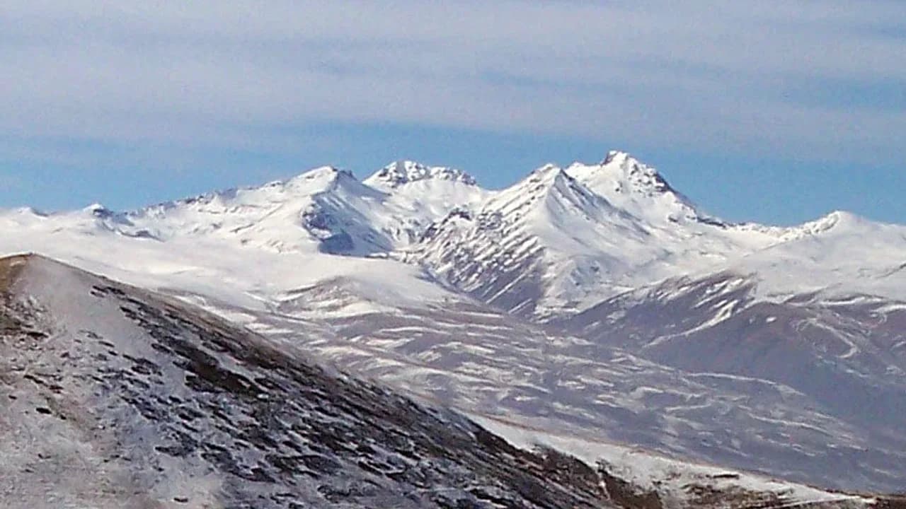
Mount Aragats stands as the highest mountain summit in the Republic of Armenia, rising to 4095 meters above sea level in Aragatsotn Province approximately 40 kilometers northwest of the capital city of Yerevan. The mountain is an immense isolated andesite-dacite stratovolcano spanning approximately 40 kilometers across its base, crowned by a massive 400-meter-deep volcanic crater ringed by 4 distinct jagged peaks: the Northern Peak at 4095 meters, the Western Peak at 4001 meters, the Eastern Peak at 3916 meters, and the Southern Peak at 3879 meters.
Why it ranks #1: Mount Aragats commands rank 1 as the absolute highest mountain summit in Armenia at 4095 meters.summit_elevation_m4095 msummit_elevation_ft13435 fttopographic_prominence_m2143 m Mount Kaputjugh stands as the second highest mountain summit in Armenia, rising to 3906 meters above sea level on the crest of the Zangezur Mountains along the international frontier between Armenia's southern Syunik Province and the Nakhchivan Autonomous Republic. Composed of hard granodiorite and Paleogene intrusive porphyritic rocks, the mountain features precipitous glacial cirques, sheer granitic cliffs, and extensive block fields that make it 1 of the most rugged and remote alpine summits in the South Caucasus.
Why it ranks #2: Mount Kaputjugh commands rank 2 as the second highest mountain summit in Armenia at 3906 meters.summit_elevation_m3906 msummit_elevation_ft12815 fttopographic_prominence_m1820 mMount Azhdahak rises to 3598 meters above sea level, anchoring the high central crest of the volcanic Gegham mountain range in Gegharkunik Province west of Lake Sevan. Formed during late Pleistocene and Holocene eruptive phases, the mountain is a massive volcanic cinder cone composed of reddish-brown scoria, volcanic bombs, and basaltic lapilli.
Why it ranks #3: Mount Azhdahak commands rank 3 as the highest volcanic summit of the Gegham Mountains at 3598 meters.summit_elevation_m3598 msummit_elevation_ft11804 fttopographic_prominence_m760 mMount Kezelboghaz, documented in Armenian cartographic surveys as Karmir Sar or Qazilgöl, rises to 3594 meters above sea level on the high Syunik volcanic plateau in southern Armenia. Situated north of the town of Sisian and southwest of Lake Tsghuk, the mountain represents an imposing volcanic dome formed by viscous dacitic and trachyandesitic lavas during late Quaternary eruptions.
Why it ranks #4: Mount Kezelboghaz commands rank 4 among Armenian peaks with an official elevation of 3594 meters.summit_elevation_m3594 msummit_elevation_ft11791 fttopographic_prominence_m520 mMount Spitakasar stands as the second highest volcanic summit in the Gegham mountain range, ascending to 3560 meters above sea level approximately 6 kilometers south of Mount Azhdahak. The mountain's name translates from Armenian as White Mountain, reflecting its striking geological composition of pale rhyolitic liparite, light-colored volcanic ash, and translucent obsidian flows that contrast sharply with the surrounding dark basaltic fields.
Why it ranks #5: Mount Spitakasar commands rank 5 as the second highest volcanic peak in the Gegham range at 3560 meters.summit_elevation_m3560 msummit_elevation_ft11680 fttopographic_prominence_m390 mMount Metz Ishkhansar, meaning Great Prince Mountain in Armenian, ascends to 3552 meters above sea level in eastern Syunik Province northwest of the city of Goris. Anchoring a prominent volcanic massif that formed along regional tectonic faults during the Quaternary period, the mountain features an eroded volcanic crater whose northern and eastern amphitheatres harbor glaciated hollows and relic cirque basins.
Why it ranks #6: Mount Metz Ishkhansar commands rank 6 as the highest summit of the Ishkhansar massif at 3552 meters.summit_elevation_m3552 msummit_elevation_ft11654 fttopographic_prominence_m680 mMount Vardenis rises to 3520 meters above sea level in Gegharkunik Province, forming the highest geographical elevation along the crest of the Vardenis mountain range that separates the Lake Sevan basin from the Vayots Dzor river system. Composed of folded Paleogene volcanic and sedimentary strata intruded by basaltic dikes, the mountain features a prominent elongated crest characterized by rocky talus slopes, steep snowfields, and glacial cirque hollows.
Why it ranks #7: Mount Vardenis commands rank 7 as the highest geographical summit of the Vardenis range at 3520 meters.summit_elevation_m3520 msummit_elevation_ft11549 fttopographic_prominence_m850 mMount Geghasar stands as a prominent volcanic dome in the central spine of the Gegham mountain range, ascending to 3443 meters above sea level in western Gegharkunik Province. Located southwest of Mount Spitakasar and south of the Azhdahak caldera, the mountain consists of thick porphyritic andesite and dacite lava flows that formed during explosive eruptive episodes in the mid-to-late Pleistocene epoch.
Why it ranks #8: Mount Geghasar commands rank 8 as a major volcanic dome in the Gegham mountain range at 3443 meters.summit_elevation_m3443 msummit_elevation_ft11296 fttopographic_prominence_m280 mMount Aramazd stands as the highest mountain summit in the Bargushat mountain range, rising to 3392 meters above sea level in western Syunik Province between the Vorotan and Voghji river basins. The mountain bears the name of Aramazd, the supreme creator deity in pre-Christian Armenian mythology, venerated as the architect of thunder and agricultural fertility.
Why it ranks #9: Mount Aramazd commands rank 9 as the supreme peak of the Bargushat mountain range at 3392 meters.summit_elevation_m3392 msummit_elevation_ft11129 fttopographic_prominence_m790 m- 0
Mount Koshadagh rises to 3317 meters above sea level in eastern Gegharkunik Province, anchoring the high volcanic ridge that extends toward the Sevan and Eastern Sevan mountain chains. Composed of dark Neogene basaltic and andesitic lavas, the peak forms a broad volcanic massif whose northern slopes slope toward the high-altitude shoreline of Lake Sevan at 1900 meters elevation.
Why it ranks #10: Mount Koshadagh commands rank 10 among the highest peaks in Armenia with an elevation of 3317 meters.summit_elevation_m3317 msummit_elevation_ft10883 fttopographic_prominence_m310 m
Have a list idea?
Start your own list and get help drafting entries with AI. A free account is required.
Create a list with AI →Think something was robbed of a spot?
Nominate a missing contender — once approved, the community votes it up or down into the rankings.
Image credits
- Mount Aragats: lenscrafters.ca
- Mount Kaputjugh (Kaputdzhukh): quicklyzz.blogspot.com
- Mount Azhdahak: youtube.com
- Mount Kezelboghaz (Karmir Sar): setlivewallpaper.com
- Mount Spitakasar: creativemarket.com
- Mount Metz Ishkhansar (Great Ishkhansar): shopee.co.id
- Mount Vardenis: walmart.com
- Mount Geghasar: one.myginne.com
- Mount Aramazd: pinterest.com
- Mount Koshadagh: storage.googleapis.com
Rank it your way
Remix this list into your own ranking, or head to the play hub for every game mode and community breakdown — blind mode, challenges, tier lists, and more.