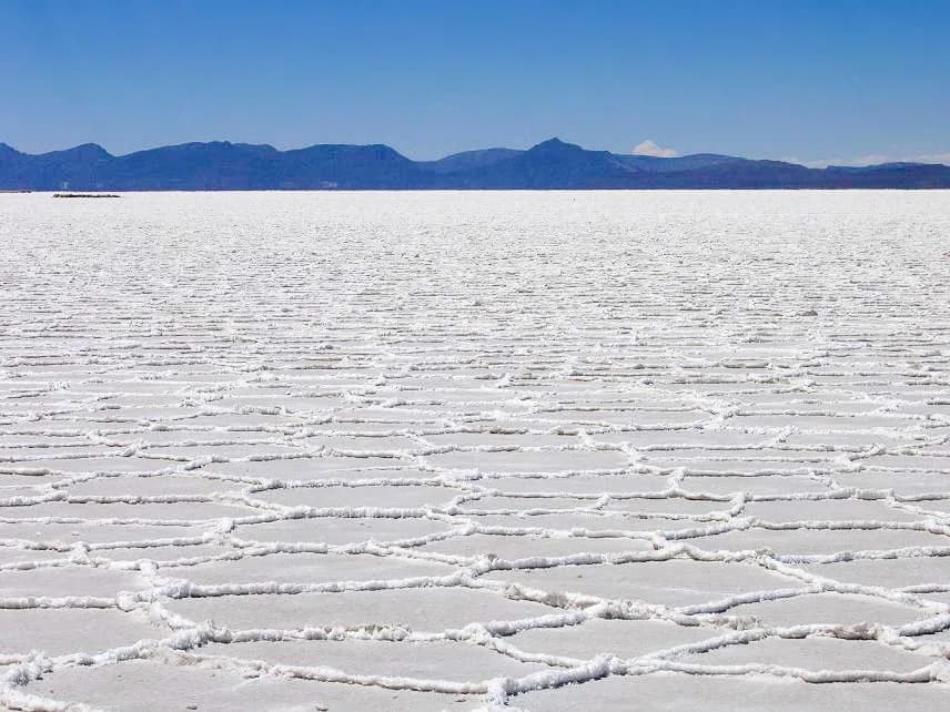
Salar de Uyuni
Company4 list appearances
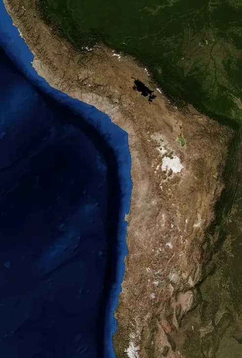
Paleolake Origin: Formed ~40,000 years ago as part of prehistoric Lake Minchin; evaporation left behind modern Lakes Poopó and Uru Uru plus Salar de Coipasa and Salar de Uyuni Gateway Town History: Nearby Uyuni was founded in 1890 as a railroad junction and mining center before pivoting to tourism Mineral Composition: Crust consists primarily of halite (table salt) and gypsum overlying lithium-rich brine Global Lithium Benchmark: USGS Mineral Commodity Summaries (2024 and 2025) report Bolivia's measured and indicated lithium resources at 23 million tons—the largest national resource globally ahead of Chile (11M tons in 2025) Scale Benchmark: At 10,582 sq km, Salar de Uyuni is ~4.77 times larger than Bolivia's second-largest salt flat, Salar de Coipasa (2,218 sq km), and ~25 times the size of the Bonneville Salt Flats in the US Satellite Calibration Utility: Exceptional flatness (altitude variation within 1 m across the salar) and clear skies make it ideal for calibrating Earth observation satellite altimeters
1-Tap Primary Ranking Ballot
Overview#4 Full List
Does Salar de Uyuni deserve the #4 spot on “Top 10 Photography Locations That Break the Internet Every Year”?
#4 Salar de Uyuni?
Verified Entity DossierRanked #4 in Top 10 Photography Locations That Break the Internet Every Year
Best Rank
#4
across all lists
Avg Position
#6.5
across 4 lists
Community
Divisive Pick
ranked #4 to #9
Most divisive on “Top 10 Desert Destinations to Visit in 2026 (From Sahara to Gobi)” — ranked #9 thereStrongest in Nature — avg #6 across 1 list
Community Weigh-In & Debate
Should Salar de Uyuni rank higher than #4 in Photography Locations That Break the Internet Every Year?
Ranked #4 on "Top 10 Photography Locations That Break the Internet Every Year". Cast your vote to back or challenge this spot.
Be the first to vote on this ranking.
Most Argued About
“Top 10 Desert Destinations to Visit in 2026 (From Sahara to Gobi)”
Ranks as high as #4 on some lists — but only #9 here. Fans are divided.
See the debate →Frequently Asked Questions
What is Salar de Uyuni's highest community ranking?⌄
Salar de Uyuni is ranked #4 on "Top 10 Photography Locations That Break the Internet Every Year" — its best placement across 4 lists on top10grid.com.
How many top-10 lists feature Salar de Uyuni?⌄
Salar de Uyuni appears in 4 lists on top10grid.com, spanning categories including TRAVEL, NATURE.
Is Salar de Uyuni a controversial ranking?⌄
Yes — community opinion on Salar de Uyuni varies widely. It ranks as high as #4 on some lists and as low as #9 on others, a spread of 5 positions, making it one of the more debated picks on top10grid.com.
What category is Salar de Uyuni most known for on top10grid.com?⌄
Salar de Uyuni appears most frequently in the TRAVEL category, most notably in "Top 10 Photography Locations That Break the Internet Every Year".
What the internet says
Structured Facts & Specifications
Verified highlightsLocation
Potosí and Oruro departments, southwestern Bolivia, adjacent to the town of Uyuni (3,665 m)
Canonical Name
Salar de Uyuni (Uyuni Salt Flat / Salar de Tunupa);
Area & Elevation
Covers ~4,085 sq mi (10,582 sq km) on the Bolivian Altiplano at 11,995 ft (3,656 m) above sea level
Authoritative Reference
Encyclopaedia Britannica Uyuni Salt Flat entry
Ontology Classification
nodeType=place; subclass=SaltFlat; Schema.org types=schema:Place, schema:Landform
Appears in 4 lists Divisive Pick


Frequently Ranked Alongside Salar de Uyuni
More Topic Lists
6
Top 10 African Tech Startups of 2025
10 items
Top 10 US 5G Technology Leaders in 2025: Carriers, RAN Vendors & Tower Companies
10 items

Top 10 Most Controversial Game Developers
10 items
Top 10 Gulf Tech Startups of 2025
10 items
Top 10 Chinese Anime & Animation Studios
10 items
Top 10 Most Successful Tech Startups of All Time
10 items