Jacky Chiu / Pexels
Top 10 Hiking Trails in Hong Kong
The 10 best hiking trails in Hong Kong, from Dragon's Back to Tai Long Wan, with distances, MTR and bus directions, best season and safety tips.
Top10Grid lets the community re-rank anything — this order is our editors' pick for now; use the buttons below to vote it up or down.

Current Rankings
- –
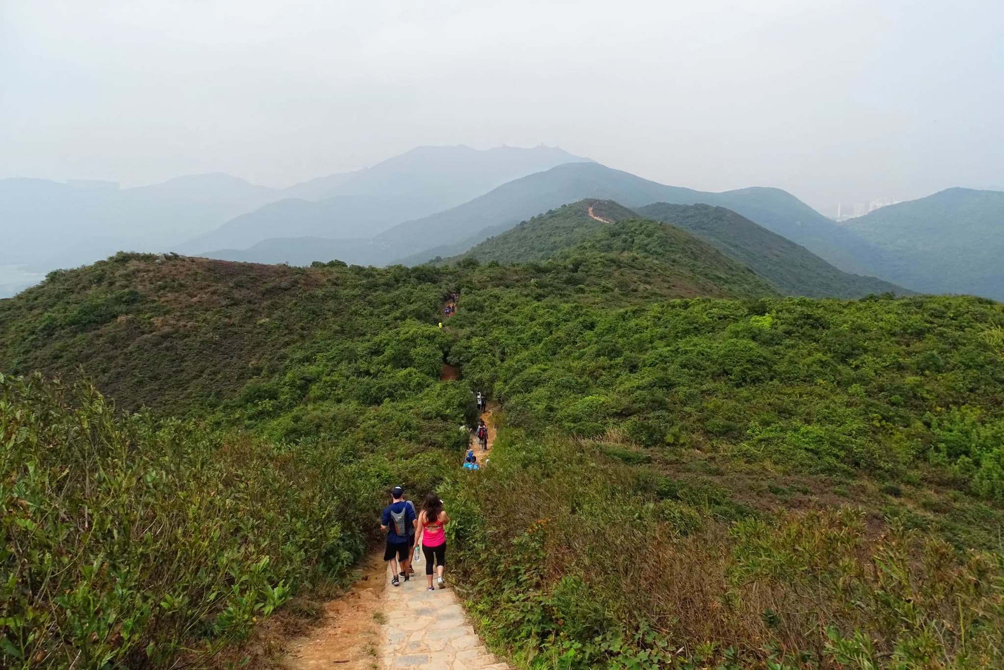
Dragon's Back is the final section of the 50-kilometre Hong Kong Trail, and the one most people mean when they say they want to hike in Hong Kong. It starts at To Tei Wan, a roadside trailhead on Shek O Road a short bus ride from Shau Kei Wan MTR, and the first stretch climbs through shaded secondary woodland before a short, steep scramble up rock and steps (known to regulars as Hobbit Hill) brings you out onto open hillside. From there the path follows the ridge that gives the trail its name: a narrow line of dirt and rock rising and dipping over a string of grassy humps, like the spine of a sleeping dragon. To the west you look down over Tai Tam Bay and towards Stanley; to the east, Shek O village, its headland golf course and the island of Tung Lung Chau. The high point, Shek O Peak at 284 metres, is a modest grassy top rather than a summit pinnacle, but the view goes all the way round and is the main reason to come. Past the peak the trail leaves the ridge and drops into the woods of Shek O Country Park. The Agriculture, Fisheries and Conservation Department describes this last part of the Hong Kong Trail as its steepest section, and the descent is a long run of uneven stone and timber steps that slows anyone in worn trainers. The path eventually comes out at Big Wave Bay, a sandy surf beach with showers and snack stalls, which is the obvious place to finish. Practically, the route is easy to plan around: frequent buses at both ends, clear signage and a length that fits into a morning. What catches people out is the lack of shade and supplies. Nothing is sold between the two trailheads and there are no bins, so take your water in and your rubbish out. Start early on a clear autumn day to get the ridge before the midday heat and the weekend crowds.
- –
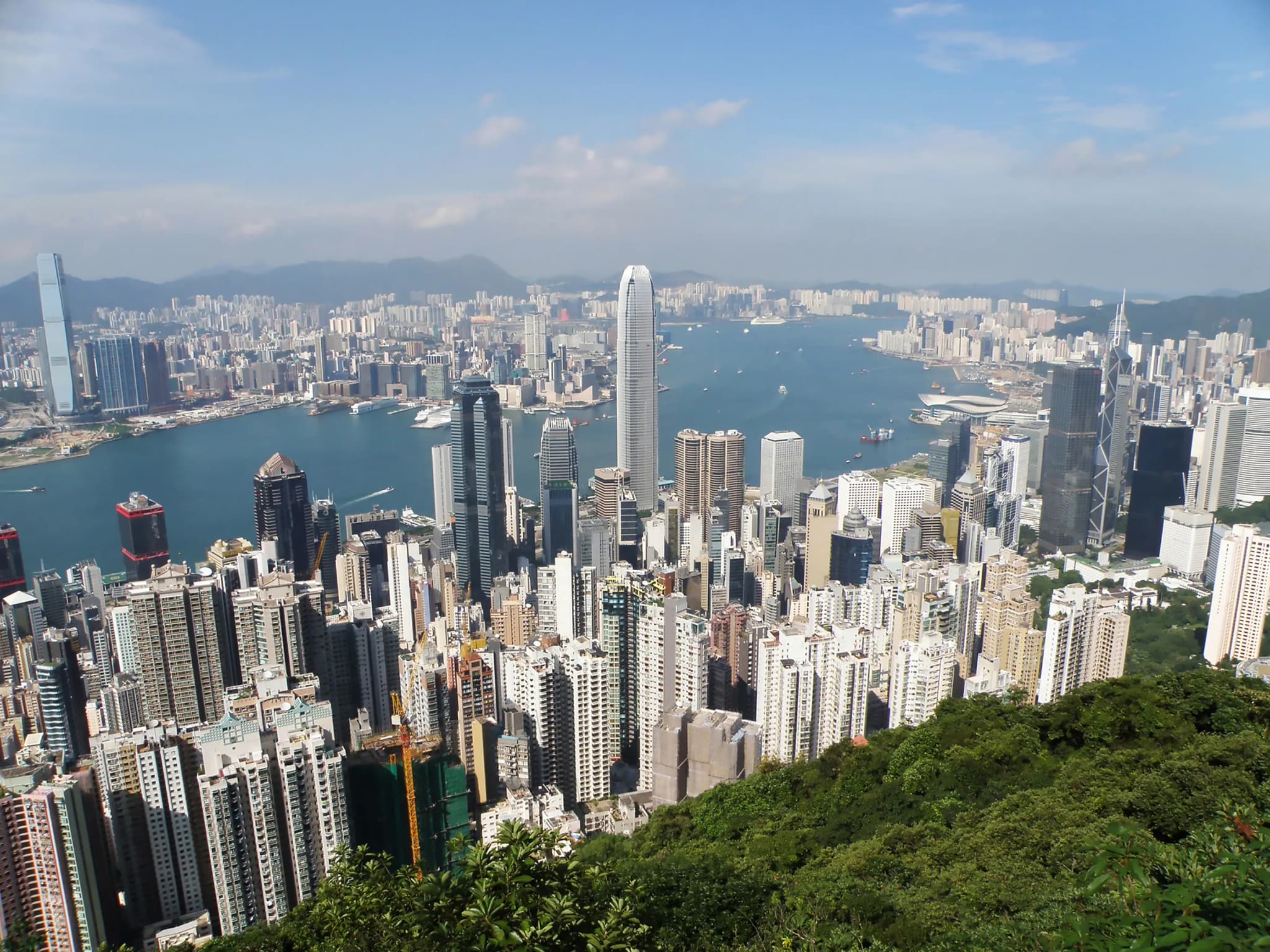
Lugard Road is the easiest way to see why Hong Kong is famous. It is a narrow contour path, built between 1913 and 1921, that wraps around the upper slopes of Victoria Peak about 400 metres above the harbour. In places the hillside was too steep to cut into, so the path is carried out over the drop on concrete piers. From the eastern half you look straight down over Central, Victoria Harbour and the Kowloon skyline, framed by old banyan and fig trees whose roots grip the retaining walls. Most visitors walk it as the Peak Circle Walk: out along Lugard Road, round on Harlech Road and back to the Peak Tower, about 3.5 kilometres of paved, almost level walking. It is also the first stretch of Hong Kong Trail Section 1, which peels off west at the Hatton Road junction and descends 7 kilometres through forest to Pok Fu Lam Reservoir, a good extension if you want a longer day. The reason to go beyond the loop is High West. From the junction where Lugard, Harlech and Hatton Roads meet, a steep flight of concrete steps climbs to the 494-metre summit in Lung Fu Shan Country Park. The effort is short but real, and the view turns the other way from Lugard Road's: west over the outlying islands and, on a clear day, Sunset Peak on Lantau. Doing both gives you the harbour panorama and a proper hilltop in one outing, and it is rare to get both on Hong Kong Island. Nearby, Lung Fu Shan Country Park also holds the Pinewood Battery Heritage Trail, a 0.4-kilometre loop through a coastal gun position built in 1905. No food or water is sold on the loop or the spur, so buy supplies at the Peak Tower first. Weekends get crowded near the Peak Tower, but the crowds thin quickly once you reach the Harlech Road side.
- –
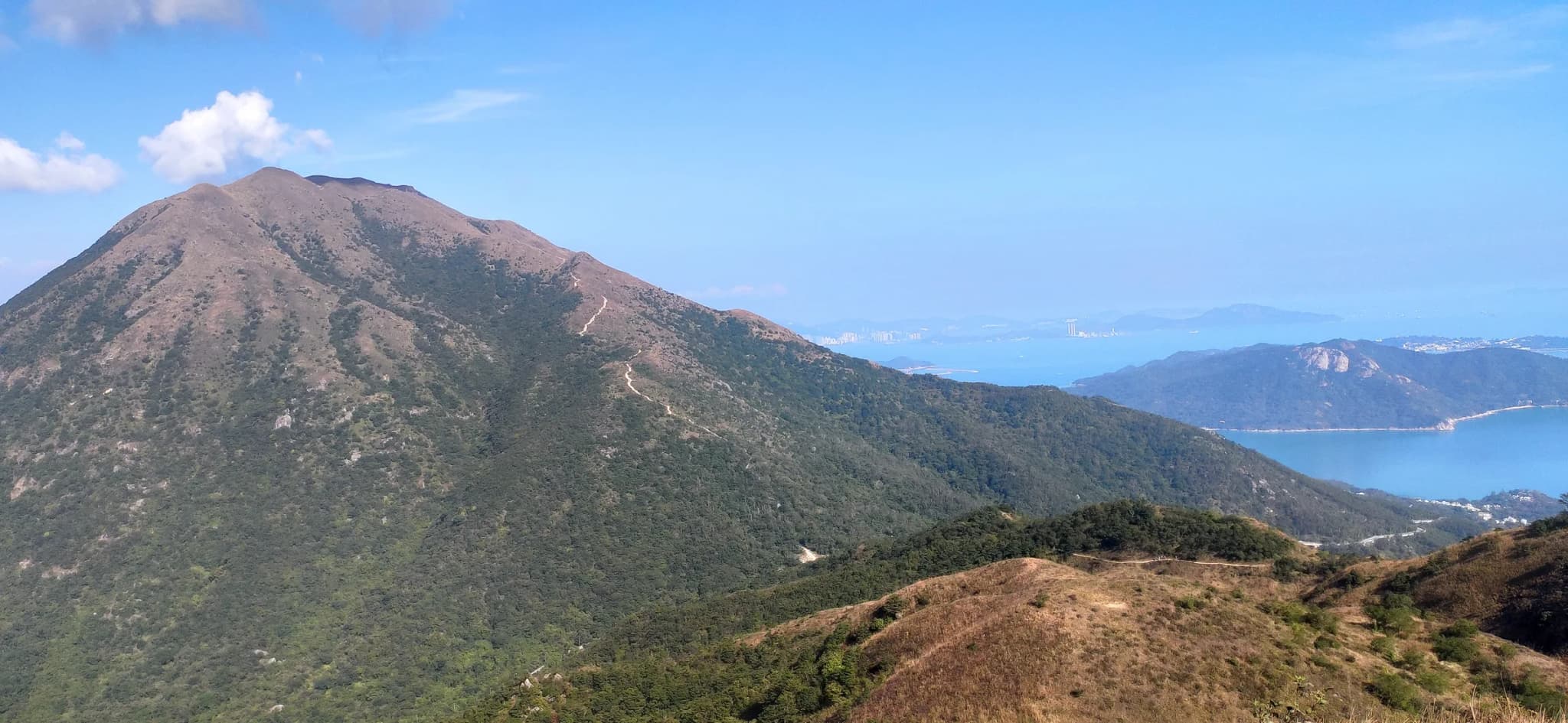
Sunset Peak is Hong Kong's third-highest summit at 869 metres, and Lantau Trail Section 2 is the way most people climb it. The stage runs 6.5 kilometres from Nam Shan, on South Lantau Road above Mui Wo, to Pak Kung Au, a pass on Tung Chung Road, crossing the mountain's broad shoulder on the way. From Nam Shan the character of the day is obvious within minutes. The path turns straight uphill on a long staircase of stone steps, and most of the section's climbing, somewhere around 750 to 790 metres, is packed into the first two kilometres or so. Then the trees stop. Above the tree line the mountain is open, wind-scoured grassland, and from autumn into winter the silvergrass covering the slopes turns gold and silver in the low sun. That season, rather than the sunsets the name suggests, is what draws the crowds and photographers. Near the top a scatter of old stone huts sits along the ridge, and hikers who camp up here pitch their tents nearby. The views are the widest on this list: across to Lantau Peak, down to the beaches at Pui O and Cheung Sha, and out over the Pearl River Estuary. The descent to Pak Kung Au is steep but short, and buses back to Tung Chung stop right at the pass. Many hikers reverse the route, starting at Pak Kung Au, which begins about 220 metres higher and makes for a gentler climb. Either way, carry everything you need. Past Nam Shan there is no water source or shade, and the exposed ridge offers few escape routes, which is why guides repeatedly warn against being caught up there in wind, mist or at dusk.
- –
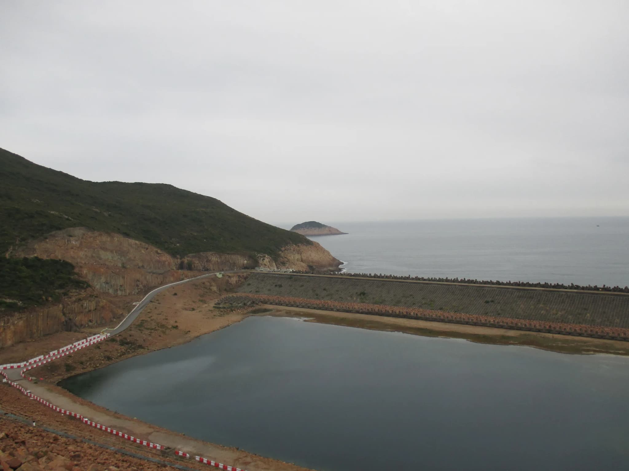
The first stage of the 100-kilometre MacLehose Trail is the gentlest walk on this list, and it passes some of the strangest scenery in Hong Kong. From the country park entrance at Pak Tam Chung, beyond which private cars are not allowed, the route follows paved roads along the southern shore of High Island Reservoir, the largest reservoir in Hong Kong by capacity. The reservoir was built in the 1970s by damming the Kwun Mun Channel, the strip of sea that used to separate High Island from the Sai Kung Peninsula. It was a response to the water shortages of the late 1960s. The result is a huge inland lake ringed by green hills, and the road crosses both of its dams. The West Dam looks across to the golf course on Kau Sai Chau. The East Dam is the highlight: the cliffs beside it are made of tightly packed hexagonal volcanic rock columns, part of the Hong Kong UNESCO Global Geopark and recognised as internationally rare. The road runs right past them, so no scrambling is needed to see them close up. After the East Dam a set of steps drops to Long Ke Wan, a small, sheltered bay of pale sand and clear water between steep headlands. It is one of the loveliest beaches in the territory, and it is where Stage 1 ends and the much harder Stage 2 begins. The catch is logistics. Long Ke has no bus, so most walkers either return along the road or continue north over the hills. Taxis can drive the reservoir road, which is how many people shorten the day. Because the whole stage is paved and graded, it is also a good choice for families, a first long walk, or a calm late-afternoon outing when the hills turn golden over the water.
- –
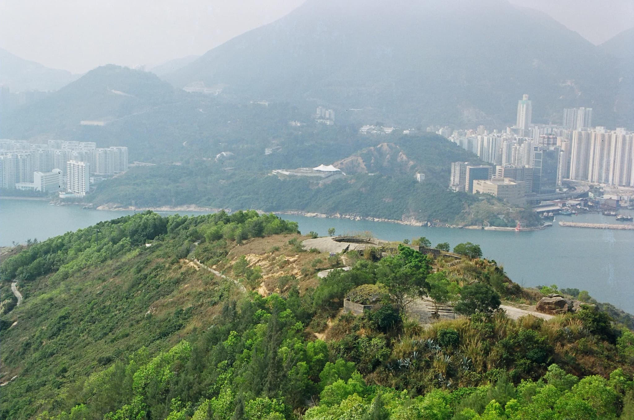
Devil's Peak is a 222-metre hill standing directly over Lei Yue Mun, the narrow strait at the eastern entrance to Victoria Harbour. It is the shortest hike on this list and packs in the most history. After Britain leased the New Territories in 1898, the military chose the hill to guard the harbour approaches. In 1914–15 it built two batteries here: Gough Battery on the upper slope, with a 6-inch gun, and Pottinger Battery lower down, with two 9.2-inch guns. A walled redoubt on the summit protected the headquarters of the Eastern Fire Command. The guns were moved to Stanley and Cape D'Aguilar in 1936. In December 1941, after British forces withdrew to Hong Kong Island, the Japanese army used the hill as an artillery position to shell the island's north shore. Almost everything is still there, overgrown and unrestored. The walk from Yau Tong climbs past a hillside cemetery onto steps and dirt paths, reaching Gough Battery first: gun emplacements, a brick-vaulted underground magazine and two unusual circular pillboxes built from concrete pipes to British commercial designs. Inside one, which is open to the sky, someone has set up plum-blossom posts for kung fu balance training. A trench runs up past a ruined machine-gun post to the summit redoubt, where a loopholed concrete wall with projecting bastions still rings the top of the hill. The views are the other reward. You look straight down on the fishing-village rooftops of Lei Yue Mun, across the strait to the old quarry cliffs of Hong Kong Island, and north over the towers of Tseung Kwan O. It works well as a late-afternoon walk that ends with dinner in Lei Yue Mun village. Bring water, as there is none on the hill, and leave time to wander the batteries rather than just ticking off the summit.
- –
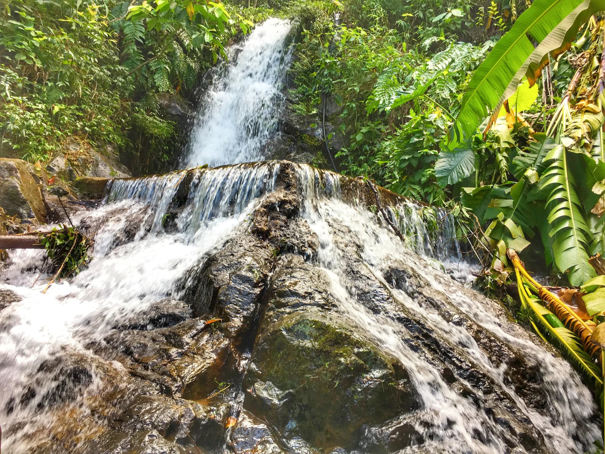
Most Hong Kong hikes are about ridgelines and sea views. Ng Tung Chai is about water. The trail climbs the shaded northern flank of Tai Mo Shan, Hong Kong's highest mountain, following a stream that drops over a staircase of waterfalls. At the top is the Main Fall, around 35 metres high and the tallest waterfall in Hong Kong. The walk starts in Ng Tung Chai village on Lam Kam Road and passes Man Tak Yuen, a small hillside temple, before the path slips into dense subtropical forest and begins to climb beside the water. The falls come in sequence. Bottom Fall, a modest drop about 20 minutes in, is followed by the Middle Fall, then the Main Fall pouring over a mossy rock face into a plunge pool. Above it is Scatter Fall, where the stream fans out thinly across a wide slab. A fainter side path leads to a further fall and is noticeably harder, so leave it to experienced hikers. Underfoot the trail alternates between concrete steps, packed earth, bamboo groves and bare rock beside the stream. Most of it is under canopy, which makes it one of the more bearable hikes on a warm day, though humidity in the ravine is high. From the upper falls you can keep climbing to the Tai Mo Shan road and loop back, turning a half-day into a full one. Timing matters more here than on any other trail on this list. After a dry spell the falls shrink to trickles. After heavy rain the stream becomes dangerous. Aim for a clear day shortly after rain, bring grippy shoes, and take a torch if you set off late: the forest gets dark early under the trees.
- –
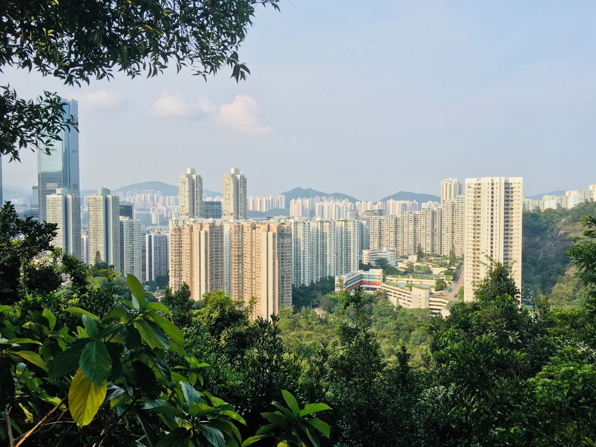
Wilson Trail Stage 2 packs two climbs, a string of war relics and some of the island's best skyline-from-the-forest views into a half-day. Most people walk it from north to south, starting at Tai Koo MTR and finishing at Wong Nai Chung Gap, where some of the fiercest fighting of the Battle of Hong Kong took place in December 1941. From Greig Road the path enters the Quarry Bay Tree Walk and climbs Mount Parker's northern slopes. Here you pass two large cement field stoves, built after Japan captured Guangzhou in 1938 as part of Hong Kong's preparations for siege. They were never used, and are the only relics of their kind in Hong Kong. Beyond a small Kwun Yam shrine the trail follows Sir Cecil's Ride, an old bridle path the Japanese used to approach the hillside, crosses Mount Parker Road, and then turns uphill in earnest. The first big climb is Siu Ma Shan, 424 metres, up a relentless staircase. The second is Jardine's Lookout, 433 metres, marked by a trigonometric point. The trading house Jardine Matheson once posted lookouts here to spot its mail ships arriving from India and London in the mid-1800s. From the ridge you look back over Tai Tam's reservoirs towards Stanley and the southern islands. A short detour leads to neighbouring Mount Butler, 436 metres, if you want one more summit. The descent to Wong Nai Chung Gap ends near a granite memorial to Company Sergeant-Major John Osborn of the Winnipeg Grenadiers. He threw himself on a grenade to save his men and was the only soldier in the Battle of Hong Kong awarded the Victoria Cross. Crowds are much thinner than on Dragon's Back, and buses leave from the Gap for Central.
- –
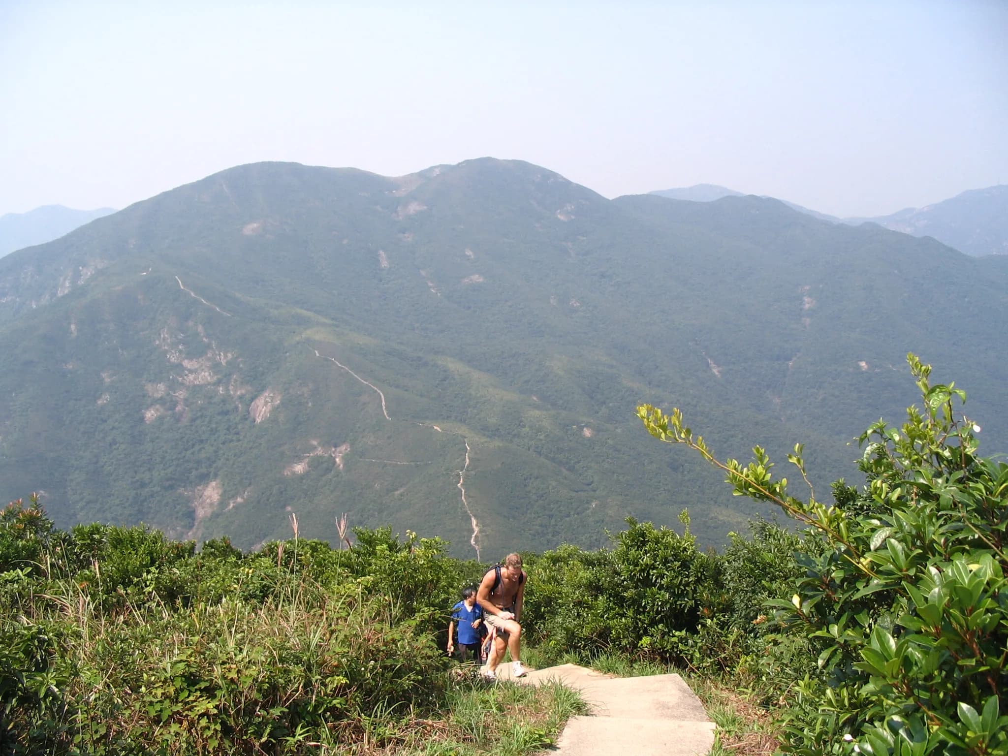
On a map this looks like a gentle half-day: under five kilometres between two bus stops. In practice it is one of the hardest short hikes in Hong Kong, and local hikers know it by its step count. Wilson Trail Section 1 crosses Violet Hill and then The Twins, a pair of steep summits nicknamed the Terrible Twins, on a near-continuous staircase from Wong Nai Chung Gap to Stanley Gap Road. The climb starts beside Hong Kong Parkview and turns quickly from tarmac to steps. Violet Hill's slopes are among the least developed on the island, covered in scrub and grass rather than buildings, and the rare Hong Kong iris grows along parts of the upper trail. With so little tree cover the views are open all the way: south over the Tai Tam reservoirs and bay, north back to Wong Nai Chung Gap and the towers of Happy Valley. A trig point marks the summit at about 433 metres. Then comes the real work. The path drops to a saddle near Tze Kong Bridge and climbs straight up The Twins, 363 and 386 metres, with barely any level ground between them. Most people find this stretch harder than Violet Hill despite the lower heights, because the steps are steeper and the rest points fewer. The payoff is a wide view of the Stanley peninsula, Middle Island and Tai Tam Bay, and a short, airy stretch near the Ma Kong Shan view compass where the ridge narrows above Stanley. The descent to Stanley Gap Road is gentler, and Stanley's waterfront is a short bus ride away. Go early in the cool season, take more water than you think you need, and take poles if your knees object to stairs.
- –
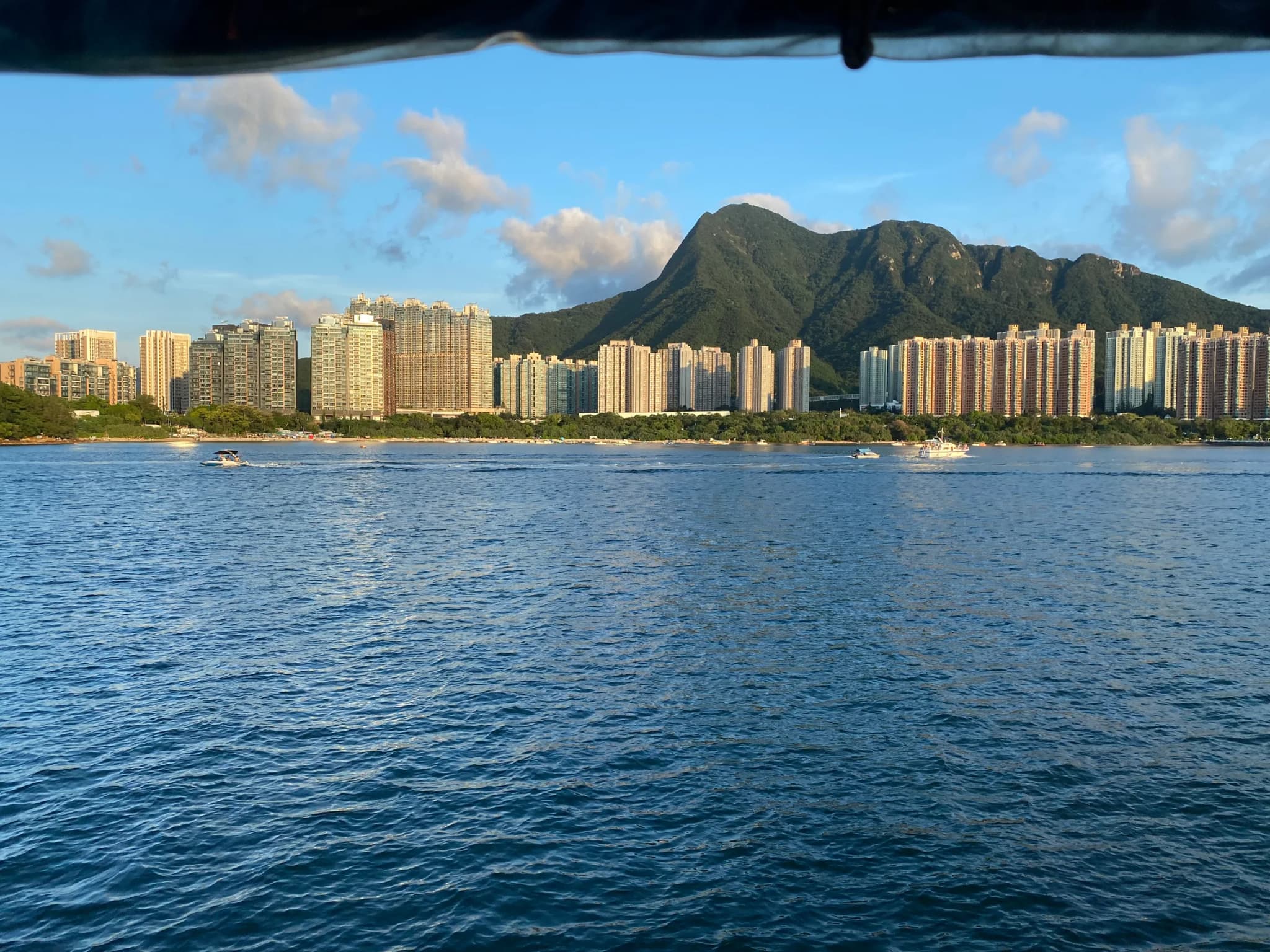
Seen from Tolo Harbour, Ma On Shan is unmistakable: two humps separated by a dip, the saddle-shaped silhouette that gives the mountain its name, which means 'saddle mountain'. At 702 metres it is not the highest peak in Hong Kong, but its summit route is regularly named among the territory's hardest day hikes, and the reason is terrain rather than height. The walk begins innocently on the Ma On Shan Family Walk, a manicured path inside the country park. Past it the surface degrades to dirt through scrub, then to a steep, loose-rock climb up Tiu Shau Ngam. Next come the Hunch Backs, a row of rocky false summits around 677 metres that need hands as well as feet. It is scrambling rather than climbing, but it is relentless. The last approach to the top runs along one of Hong Kong's most photographed ridgelines: a narrow spine of bare rock with the green hills of the Sai Kung peninsula dropping away on one side and Tolo Harbour and the towers of Ma On Shan town on the other. The upper mountain is open grass and shrub on volcanic soil, a sharp contrast with the forested lower slopes. On the south-west flank lie the remains of the Ma On Shan iron mine, worked from 1906 until 1976. After the summit most hikers drop onto MacLehose Trail Section 4 and cross the Ngong Ping plateau, a broad, gentle grassy tableland once used for grazing, before a long staircase down into Sai Kung and a seafood dinner on the waterfront. Take at least two litres of water, start early to beat both the heat and the afternoon cloud that often hides the summit, and save this one for dry days. Mobile signal is patchy near the top.
- –
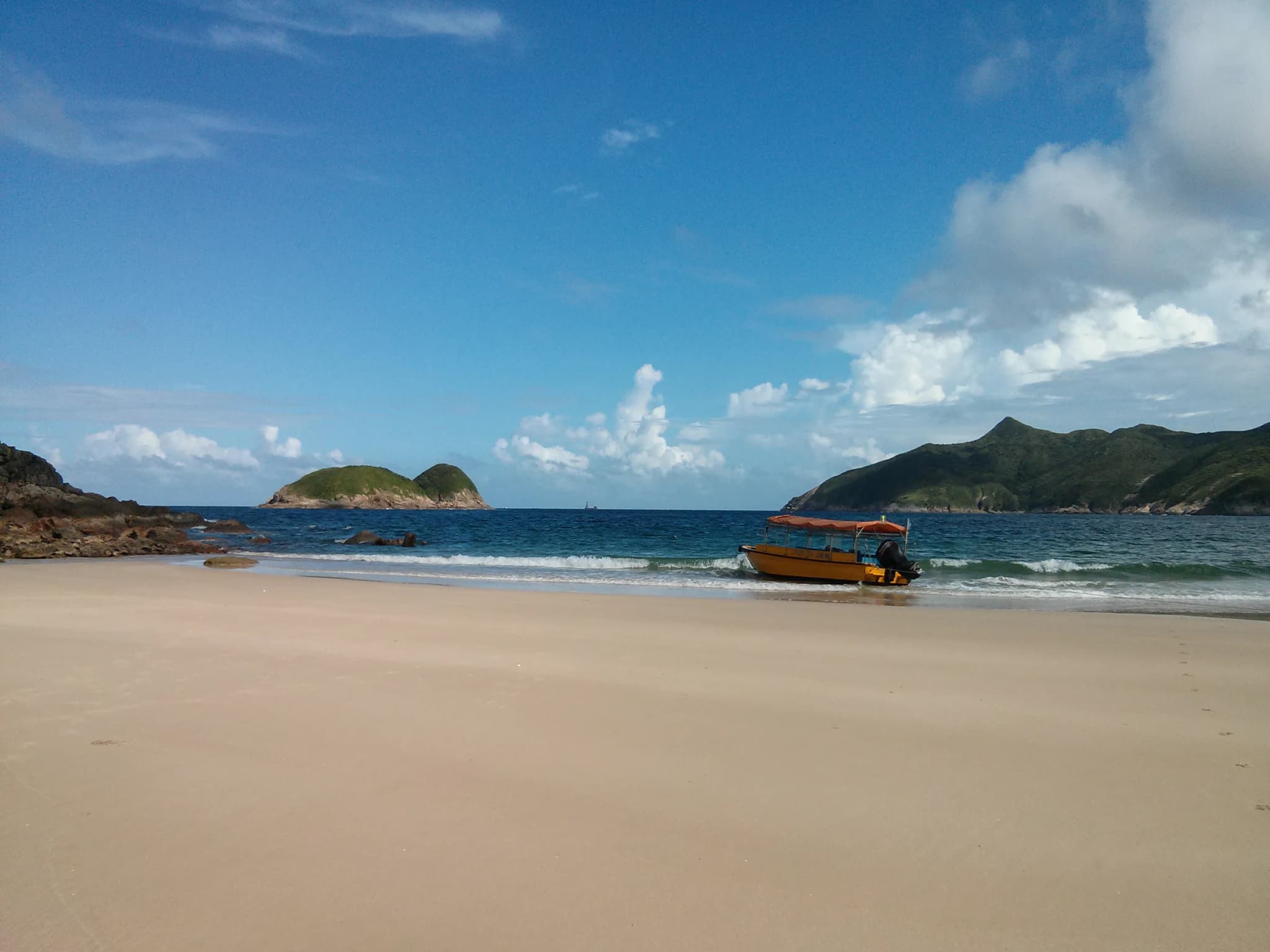
If this list ranked on scenery alone, this stage would be near the top. Tai Long Wan, meaning Big Wave Bay (not to be confused with the one at the end of Dragon's Back), is a string of wide, white-sand beaches backed by green mountains. MacLehose Trail Section 2 is the trail that walks the whole length of it. It sits at number ten because of the effort involved: no transport at the start, a long, exposed day, and a stiff climb straight away. The stage begins at Long Ke Wan, where Stage 1 ends, and immediately climbs Sai Wan Shan, 314 metres, with no tree cover at all. From the top the view opens north over Tai Long Wan's beaches and the dark pyramid of Sharp Peak behind them. The trail drops to Sai Wan, a small beach with a campsite and natural rock pools, then follows the coast over short headlands to Ham Tin, the social hub of the bay. Ham Tin has a couple of family-run stores selling drinks and noodles and a boardwalk over the wetland behind the sand. From Ham Tin the trail turns inland through the Chek Keng valley, past old Hakka village sites and terraced fields long since reclaimed by forest, before a final sustained climb to the road at Pak Tam Au. There are toilets there and minibuses back to Sai Kung. Many hikers make it a two-day trip, camping at Sai Wan or Ham Tin. Others take the calm-weather kaito from Sai Kung to shorten the approach. However you do it, start early and bring swimwear: the sea here is the best reward on any Hong Kong trail.
Image credits
- Dragon's Back: Photo by Bjørn Christian Tørrissen, CC BY-SA 4.0, via Wikimedia Commons
- Lugard Road Circuit & High West, Victoria Peak: Photo by Exploringlife, CC BY-SA 4.0, via Wikimedia Commons
- Sunset Peak (Lantau Trail Stage 2): Photo by Nhk9, CC BY-SA 4.0, via Wikimedia Commons
- MacLehose Trail Stage 1: High Island Reservoir: Photo by Underwaterbuffalo, CC BY-SA 4.0, via Wikimedia Commons
- Devil's Peak: Photo by Gindrinkersline, CC BY-SA 3.0, via Wikimedia Commons
- Ng Tung Chai Waterfalls: Photo by cattan2011 (Flickr), CC BY 2.0, via Wikimedia Commons
- Wilson Trail Stage 2: Jardine's Lookout: Photo by KennethFKL1994, CC BY-SA 4.0, via Wikimedia Commons
- Violet Hill & The Twins: Photo by Minghong, CC BY-SA 4.0 (also GFDL 1.2+), via Wikimedia Commons
- Ma On Shan: Photo by LN9267, CC BY-SA 4.0, via Wikimedia Commons
- MacLehose Trail Stage 2: Tai Long Wan Beaches: Photo by Kaldari, CC0 1.0, via Wikimedia Commons
Rank it your way
Remix this list into your own ranking, or head to the play hub for every game mode and community breakdown — blind mode, challenges, tier lists, and more.
You Might Also Like

Travel Books That Make You Book a Plane Ticket
Travel Books That Make You Book a Plane Ticket

10 Most Beautiful Temples in Asia: From Angkor Wat to the Golden Pavilion
10 Most Beautiful Temples in Asia: From Angkor Wat to the...

Top 10 Things to Do in Los Angeles
Top 10 Things to Do in Los Angeles

Top 10 Worst Airlines in the World
#1 Spirit Airlines · #2 Ryanair · #3 Pakistan International Airlines

Top 10 Experiences in Casablanca
#1 Hassan II Mosque · #2 Rick's Cafe · #3 Corniche Atlantic Waterfront

Top 10 FIFA World Cup 2026 Host Cities and Stadiums You Must Experience
#1 Mexico City · #2 New York / New Jersey · #3 Los Angeles